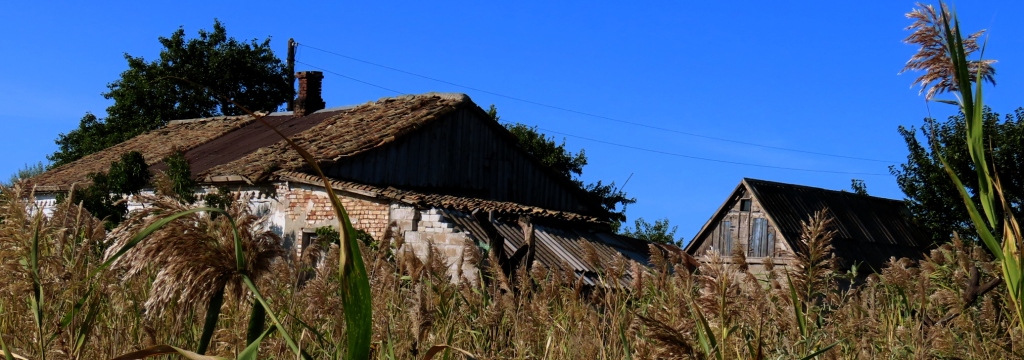
Before and After: Path northward from Gri gri Beach, Souillac, left, and, right, a sugar cane field near Trois Boutiques, south of Mahebourg. Actually, the view on the right is one I saw several places in this island. This crop is sadly ubiquitous throughout the country. The one on the left required a bit of hiking to get to. And if you look carefully, even in this picture on the left, biodiverse degradation is also visible, starting with the “pine” trees, Beach Sheoak, Casuarina equisetifolia.
It is hard now to imagine what this island was like centuries before. It must have been really beautiful at one time. Mark Twain wrote,
“What there is of Mauritius is beautiful. You have undulating wide expanses of sugar-cane—a fine, fresh green and very pleasant to the eye; and everywhere else you have a ragged luxuriance of tropic vegetation of vivid greens of varying shades, a wild tangle of underbrush, with graceful tall palms lifting their crippled plumes high above it; and you have stretches of shady dense forest with limpid streams frolicking through them…” – Following the Equator, 1896
In more recent times new invaders have made this island noticeably less beautiful and, more to the point, less biodiverse. Some of these invaders are themselves beautiful to look at, but what they are doing to the island is not. Main Avian Invaders: The Feathery Five: When we see a bird here in Mauritius there is a 95% chance it will be one of these five. What do these birds have in common? They are all invasive, having pushed out, or in the process of pushing out other species. Biodiversity on this island has taken a major hit. Here are those bad boys. Clockwise from top left:
Common Myna, Acridotheres tristis. Aside from pushing out other birds these birds act like little “Johnny Appleseeds”, introducing other trees and plants that have no business being here. The Mynah, for instance, loves the fruit of the Strangler Fig (Banyan) and, well, “plants” the seeds wherever it flies.Red-whiskered Bulbul, Pycnonotus jocosus Zebra Dove, Geopelia striata. These first three birds all came from various regions of Asia.Village Weaver, Ploceus cucullatus, from Africa mainlandRed fody, Foudia madagascariensis, from – you guessed it – Madagascar.
Other invasive species, not birds, have also given the island an ecological drubbing. Here are four for dishonorable mention:
Small Indian Mongoose, Urva auropunctata, brought over from India to bring the rat population down. The rats had swelled in number when the island was given over to Sugar Cane cultivation. Well, the Mongoose did a middling job on those rodents – and also on native birds. Oops.Guttural Toad, Sclerophrys gutturalisMadagascar Giant Day Gecko, Phelsuma grandis, from nearby Madagascar, very aggressive toward native reptiles. But, like a lot of these invaders, very photogenic. So … there is that.This Asian House Shrew, Suncus murinus, wouldn’t stay long enough for a decent photo. He’s on a quest for insects and animals, some larger than him. He is the cause of the 2011 extinction of the Orange-tailed Skink, Austroablepharus naranjicauda on Flat Island, located off the north coast of Mauritius. The skinks, endemic to that little island, were no match for the shrew, which inadvertently came over with a lumber shipment. The skinks, in only fifteen months, went from thousands to zero. Fortunately zoologists were able to rescue some and relocate them to two nearby uninhabited – and unshrewed! – islands. Fingers crossed.
Here is a glimpse of this most intriguing Nicaraguan Island. It was both enjoyable and frustrating. More on that later. Here are some pictures, most of which can be selected for a better view.
Volcan Concepcion dominates the left half of the photo. This was taken as our ferry approached Moyogalpa, also visible on the left. On the far right distance is Volcan Madera, the other volcano that makes up this dumbbell-shaped island. Most nature enthusiasts try to make it to this more remote volcano because the wilderness is better protected there. But, at least when we were there, the roads were worse and the hotels more expensive.
The gash on Volcan Concepcion is from the most recent eruption in 2010. It was a rather dangerous event, villagers were warned to leave the island but, as is the case in places like this, almost all preferred to stay.
The maps below show clearly the dumbbell shape of the island, most of the landmass being slopes of the volcanoes. Very fertile slopes, too. The residents have long since planted fields ever creeping up the slopes of the volcanoes. Most of the population – and the better infrastructure – is on the north part of the island. This can be seen by the greater number of services and tourist accommodations on the map on the right. But the southern volcano has more pristine nature. Unfortunately, harder to get to and more expensive to stay there.
The map on the left shows the four places where we spent the most of our time. The ferry landed at Moyogalpa and that is where we spent the first night or two. After that we took a creaky bus over to Altagracia on the northeast coast. In between the two mountains is a stream and a nature trail with fantastic large trees. I felt like I was on the set of Jurassic Park! No dinosaur, though, but I did blunder onto a trail of angry ants. Really painful bites! Lots of them. And I was on the trail too.
A lot of the horse power here was also burro and oxen power.Left. Tamarind tree. The fruits here are not ripe yet. Center. Our lunch in Balgue. Tilapia for her and spare ribs for me. Also fried bananas covered with corn meal. Right. On our vain trip to find a nature trail on Concepcion we saw these young fellows energetically threshing sorghum against a wooden beam.The slope of the southeastern volcano, Madera, trends more directly into the lake. The overall lack of level land hinders population growth here. Less population means less roads and cultivation – better wildlife. The photo above is of our vain attempt to get to a nature trail on the northern volcano. Cultivation was obvious on both sides of the dirt road. Finally – by this time we were pretty tired out – we came to what you see here. Does this look like a nature park? Disappointing.Animal life here is spectacular if you go to the right places. Most of these photos are from the Charco Nature Reserve. Clockwise from the top-left: 1. Ringed Kingfisher,Megaceryle torquata. I saw this bird along with the Amazon Kingfisher. Fishing must be good at the Charco Reserve. 2. Mangrove Swallow, Tachycineta albilinea, greeted us as we approached the port of Moyagalpa. 3. Mantled Howler, Alouatta palliata. We saw several of these at the reserve. 4. White-throated Magpie-Jay, Calocitta formosa. One of the loudest and most common of birds, but always fun to watch. 5. Summer Tanager, Piranga rubra. A familiar bird from the US. 6. Black-headed Trogon, Trogon melanocephalus. If you look carefully you can see the spider web by his beak. He is helping himself to the odd bits of insects, wrecking the spiders handiwork in the process.
Center. This photo does not belong here – but neither do these two boys, caught fishing in the Nature Reserve. Poaching is a serious problem here. It is especially serious for the Yellow-naped Amazon Parrots. This island is the last, best refuge for this endangered bird. Many of the nesting sites are robbed of eggs and chicks and sold to the illegal pet trade. And many of the locals, about one fourth of the homes on Ometepe, have these parrots as pets.
Deforestation and general degradation of natural resources will be a theme that comes up time and again in our travels. Admittedly, as travelers and writers about our travels we add to the problem, since we give helpful information to future travelers. But hopefully they will travel with as light a footprint as possible – as we also try to do.
A view from our second apartment. There is always fascinating people-watching,
So many experiences we have had from our five years in China. It seems it will still require many more years to unpack them all. Here are a few glimpses from the two areas where I taught: Jilin in the province of the same name and Kaifaqu, one of the northernmost of the cities clustered around Dalian, Liaoning.
JILIN
Another view from our window in Jilin. Chinese chess. A favorite pastime, especially in Jilin. It was not unusual to have a crowd of spectators watching. a sidewalk game. In Dalian we saw this too, although cards seemed more common there. If you look closely you can see the wooden pieces here are well-worn, as is the board. A sign of heavy use. One of my students tried to teach me the rules of the game, but I did not do too well against him. I just could not wrap my head around this game.Jiefang Street, Jilin. I liked this shot so much I made a poster of it. We did our shopping often in Walmart (on the left). Jilin.
Jilin. We often get out of our high rise and try to find some nature. These woods had some graves with offering of fruit and Baijiu (potent rice alcohol) for the deceased. In these woods I heard a fairly rare songbird. When I tracked it down I saw that it was in a cage hanging from a tree. Around the bird was a mist net. This is how they trap the few birds to sell in the market. Criminal! Further up the Songhua (the main river of Jilin City) I read an account of villagers stringing a net across the whole river!
One of my brightest students. She quickly went way beyond the usual boring textbooks. First we went through “1984” and then, after a false start with “Wuthering Heights” (too arcane!), we had several good lessons from Plato. Da Dong Men School, Jilin. My students came in all sizes.Dalian. I snuck this photo of this gentleman as we were exploring this city. What stories he could tell! He must have seen great changes in his country. I really wished I could have talked with him, but at this point I was basically at my “Where can we eat? Where is the bathroom?” level.Dalian-Kaifaqu. View of our school – and of our apartment in the smoggy distance. We were just one floor under that leftmost “hat”. We were on the 25th floor.Dalian-Kaifaqu, our school. Our second apartment while at this school is just outside the left edge of the photo. The foreshortening of this telephoto make sit look like the apartments are conveniently next to the campus, but we had trudge daily down a dirt road, often dusty dirty or muddy, to get to school.
Dalian-Kaifaqu. I am taking a breather before showtime. This was on the eve of our performance at opening of the school year. We sang and then performed a humorous skit.
Like I said, these are just random reminiscences. A lot of good experiences, maybe half as many bad ones. But I am a “glass half full” guy.
This is the final installment in this series. Most of these photos can be selected for a better view. The ones that are grouped in twos or threes, especially, can be selected for a much more detailed view. I took great care in selecting and improving these photos from our trip this area in the Fall of 2020, I hope you enjoy them.
I highlighted here the four cities that are in this blog entry. Our route through them formed a backward “N”.
ZAPORIZHIA
Unlike the previous two cities, Zaporizhia is not under Russian control.
Zaporizhia on the wide Dnieper River has a long and illustrious history. Scythians lived all around here perhaps as far back as 1000 BC. Also Turkic Khazars, Kumans, Tatars, Cossacks, and Slavs made this area their home.
These Cossack in this bus stop mural remind me of the characters in “Taras Bulba”.
Being a navigable river, it was well-known to Greek traders. The Greek geographer Herodotus wrote about the Dnieper:
“As far inland as the place named Gerrhos, which is distant forty days’ voyage from the sea, its course is known, and its direction is from north to south; but above this, no one has traced it, so as to say through what countries it flows. It enters the territory of the Scythian Husbandmen after running for some time through a desert region… It is the only river besides the Nile the sources of which are unknown…” The Histories, Book IV.53
The first written record of Zaporizhia was in 1492, the same year that Columbus sailed the ocean blue!
The whole area on both sides of the Dnieper was known as the “Wild Fields“, the largely untamed region that the surrounding powers (Polish-Lithuanian Commonwealth, Grand Duchy of Moscow, and the Ottoman Empire) were either unable or unwilling to claim. But finally in 1789 Catherine the Great of Russia invited Mennonites to settle in this area. They came over en masse from Prussian Danzig. The island of Khortitza, erstwhile stronghold of the Cossacks, was given over to these Mennonites for a “perpetual possession”.
But perpetuity was not to be had. In 1914 the Mennonites sold the island to the city and the majority eventually left. The Russian Revolution and World War 2, especially, meant hard times for them. Many of those who did not see the writing on the wall and emigrate to the New World were forced to relocate to central Russia and Siberia.
Holy Protection Church on Lenina Street.The Church of Saints Peter and Fevronia. A telephoto from the apartment window.Lots of international franchises and big box stores like Epicentr, on the right.The Hydroelectric dam, built by the Soviets in 1932.
Matching the “Wild Fields” there was also the “Wild River”. Because of the Dnipro Rapids, navigation was always a tricky proposal. The most dangerous of these rapids, fatal for many, was the Nenasytets, (“Roaring Rapids”). Pilots, when they approached the fearsome site, changed into a clean shirt and read the Lord’s Prayer. If you are going to die and ““knock on Uncle Peter’s door”, it was said, it is best to do so prayed up and in a clean shirt.
Despite the dangers the ships kept coming, seeing that this was an important route that led all the way up to the Varangians (who had migrated south from Jutland and southern Sweden). Testimony to the failures and successes of traders on this route are burial mounds as well as forts and sanctuaries.The original (left) Dnieper Route connecting the Varangians with other ancient trading partners, as well as later alternate routes, chosen because the growing dangers of going up the Dnieper. The purple area was the territory of the Rus, the term “Kievan Russia” or “Kievan Rus” did not exist until the 19th century. Those latter terms are often used to legitimize the nationhood of Ukraine much earlier than is warranted.
With the building of the Zaporizhia dam in 1932 the danger of rapids were mostly a thing of the past. So were many villages. The water level rising 40 meters, dozens of villages on both side were flooded. But with the dam the cities of Zaporizhia, Dnipro, and Kiev now had port access to the Black Sea.
But the Soviets added another chapter to this dam story. In 1941, in WW2, they blew a large breach in the dam, flooding the area all the way down to Nikopol. This killed thousands of civilians, as well as soldiers on both sides. The death toll was between 20,000 and 100,000. Later in the war the Germans used forced labor to repair the dam.
Dnieper River. This barge is heading out to the Black Sea. On the far shore is Khortytsya Island, once home base to the Zaporizhian Cossacks. Earlier reachable only by boat, this very long island is now reached by five bridges. There is a nature reserve in the north part of it. At one time there was a native moose population here but farming and poaching, especially, led to their extinction here. What is most probably still in the island – somewhere – is buried treasures from the Cossacks. In between their wars and plundering forays they cached their goods in hidden spots. Of course, if they died in subsequent adventures the location of these treasures would be lost, some being found by farmers or metal-detectors.It was only a short walk from the apartment to the Dnieper. Left. Marsh Frog. Center. Birch trees and meadows This is what I imagine much of this area once looked like. Right. Grey-headed Woodpecker.Vegetable and fruit vendor right under our window.This is the type of transportation we took to the next major city upriver , Dnipro.
A good city guide is linked below. I usually do not pass on these types of links because they are usually poor quality. This one seems well-designed and quite useful. Pegasus Airlines, a Turkish company. Unfortunately, they do not cover the other three cities in this article. https://www.flypgs.com/en/city-guide/zaporizhia-travel-guide.
DNIPROAbove: The view from our apartment in Dnipropetrovsk – often mercifully shortened to Dnipro. The next several photos are all of Dnipro.Much of the downtown area of Dnipro is in the grand Soviet style.There are several rocket displayed near Heroiv Garden Square, near the city center. Shown here is the Tsyklon-3 (“Cyclone”) rocket. Along with the previous Tsyklon-2, Kosmos, and Zenit, these were prime examples of the city‘s secret successes in rocketry. This company also produced the Sputnik satellites that would soon astound the Western world.
The production of these rockets had to be a secret, both to the outside world and to other citizens of the Soviet Union. The company that made these also made heaters, electric juicers, and a host of other household appliances, as well as nuts and bolts, etc. Everything from toasters to tractors. And that is what the company, Yuzhmash, was officially known for, and what they advertised – nothing related to military or space tech. Many of the workers themselves and their families, naturally, did know about that second line of product. This (if we add the families) would be over half of the city!
So, in order to keep their clandestine product under wraps, in 1959 they made the entire city a closed city. No one from a foreign country, even communist countries, were allowed into the city. But the citizens themselves began referring to their city as the “Rocket City“.Views of Heroiv Garden Square. Except the top center frieze which was near the Transfiguration Cathedral.This is listed as a newspaper publisher. But at the time I thought I saw a news van with cameras, so I am not sure what it is.Left: Heroiv Garden Square. Right: Sidewalk in front of ATB-Market, a pretty convenient supermarket chain. The lady on the right is working a Schwarma kiosk. Note the sign for french fries: Kartofel Fry.Transfiguration Cathedral. Prince Grigory Potemkin had great plans for this church but the Russo-Turkish War (actually, the sixth of such wars in a series of ten, 1568 to 1878!) caused a delay of many years. Finally in 1835 the church was built, but on a much smaller scale. Further diminution of Potemkins grand vision for this church came when the Soviets closed it in 1930. And from 1975 to 1988 it became a “museum of atheism” (Wiki). Because as a response to that insult, an earthquake that last year put an end to that use of the building.
“What are you doing here?”
This was the question put to us by a young couple whose apartment we rented in Kryvyi Rih, a city as hard to pronounce as it is to spell.. Part of it was just a finger-on-the-map whim. Also it was on the way back to Kiev, where we were due soon to fly out. It seemed like a normal Ukrainian mid-sized city, not touristy at all. And that is usually a plus for us.
But for them it was odd, the equivalent of a foreigner from, say, China wanting to see Cleveland or Wheeling, West Virginia.
The interior of the Orthodox Church in Jubilee Park built “in honor of the Mother of God “Perishing” , in honor of the fallen soldiers in Afghanistan, and members of other local wars.”One of the largest flower clocks in Europe. Below it is a museum of local history.This city is most known for its iron ore mining. Huge sections of the city are devoted to industry and open-pit mining and related industries. Do you see that pollution? It is a real problem. This city has the worse air in the Ukraine thanks to the mining and resultant steel processing.
Stalin’s rapid and brutal industrialisation of the city in 1931, coupled with the collectivisation in the country kick-started the growth of the city.
It was rapid: In 1941The city had grown exponentially, a tenfold increase in population, over 200,000. It was brutal:Collectivisation of private holdings from generations past, stealing their harvest, and the resultant famine. Millions starved in the whole USSR in the 30s. But by 1941, at over 200,000, the population of Kryvyi Rih had increased almost tenfold to 200,000.The Tram System is pretty convenient. In all of our travels I think this is the first time I read of a city giving free transportation to their own citizens. As of May 1st, 2021 the city started giving them free rides.They need only to present their “Kryvyi Rih Card”. Great idea.Rooks are common in Jubilee Park. As a Westerner I always do a double-take when I see one since they are not in our hemisphere.Along with the industrialization there are beautiful and serene scenes as well.The two pictures above are Saksahan part of the Inhulets River, in the south part of town. The view immediately above is of Rock Eagle’s Nest. It was difficult to get here. After coming by tram we walked quite a ways though thick brush, the path being hard to follow.
There are many exposed ferrous outcroppings, some marred with graffiti. But the view was spectacular.The market area downtown. Very clean. Notice the mural with the general color scheme of the Ukrainian flag.This fort was also in Jubilee Park.Left: The bus station we left from as we headed north again. The city being almost 100 km (78 miles) long (and 20 km wide), there are several bus and train stations. This is the longest city in Europe! Right: Old and New Propaganda.
Kropyvnytskyi
his city, the last in our series on Ukraine Between The Wars, draws less-than-glowing praise from Wikivoyage. It is “not famous for its places of interest, but the downtown still bears the remnants of old architecture.” They also add “The locals like to call Kropyvnytskyi “a little Paris” due to its resemblance to Paris before the Soviet Union have destroyed the look of the city in the 20th century.”
From the same source I learned about – but did not see – Fortress Elizabeth, “the oldest preserved Earthen Fortress in Europe.”
We only spent one day here so I do not have much to comment about this pleasant city.
This could be a photo from a hundred years ago – if you do not look too carefully.
I hope you enjoyed reading these articles. Feel free to write. Comments, corrections, praise, censure – all equally welcome. Below are links to all of my Ukraine articles:
At first we were going to just avoid the entire southeast area of the country but finally decided on venturing in, at least to the northern and western section of this region. Its a good thing we did this at that time. We were able to see those oblasts while things were relatively peaceful.
All of that has changed now of course.
The first city was Kramatorsk, at the time in the western part of the Donetsk Oblast. See the map below. The three cities in blue letters are the ones this blog entry will focus on. As you can see, the first two cities, Kramatorsk and Mariupol, are part of the Donetsk. (Those two oblasts – rather, republics -in yellow make up the Donbas Region.)
Recycling Center close to our apartmentYoung family in front of the stairwell next to ours.Before and After. We stayed on the fifth floor of the building on the left. . Play area marked out with colored tires. The photo on the right, from this year, shows extensive damage of a building nearby.Yuir Gagarin, Soviet cosmonaut, was from Ukraine. Back then it was The Ukraine (“the border”) – a reflection of Soviet hegemony.Above and Below: 1. Old and new factory and power plant. Novokramatorsky Mashynobudivny Zavod. The company manufactures various machine parts and products, including military items like submarine components. Not sure if it is still operating. There have been no Google reviews for 3 months.
For that matter, many of the plants and business have shut down or been seriously hampered by recent events. Over three-fourths of the city (per a source a month ago) have left the city. Power, gas, and basic necessities are in short supply.Military poster at the entrance to a park.A resident of the Bilenke neighborhood on the northeast edge of the city tends her cornfield.This city, like much of Ukraine, is divided on their attitude concerning the neo-nazi factions.Helicopter patrol over the central part of the city.A the entrance to our apartment building was this bulletin board. The flyer on the left warns about unexploded ordinance still present in many areas. This warning concerns the ordinance from the last eight years of shelling. Since the time of this photo (September 2020) this danger has increased dramatically.“God is ahead”? Hmm. There are two ways to take that. But I hope the sign is right. This country is seeing so much suffering.
As bad as the infrastructure damage was in Kramatorsk it was much worse in Mariupol. Surely it was more of a priority owing to its strategically important port on the Sea of Azov, as well as the Azovstal Steelworks. Having eliminated the army units within that factory complex, Russia is in the process of renovating the entire area as part of their beautification of the city. If I had known how important this place was to be after we left Mariupol I would have taken lot more photos!
The Mariupol Cathedral is in the city center. We were not able to go inside, maybe because of the construction.The next three photos are of the downtown area. I am sure it has all changed considerably.March 16 of this year Mariupol’s Donetsk Regional Drama Theater (above and below) was bombed resulting in 300 dead. The number is not certain, this figure being asserted by the Ukrainian government. Both CNN and BBC treated that number as reliable although the latter even admitted that “it is hard to independently verify information”. What becomes increasingly more uncertain is the original media narrative that is was a Russian missile attack. The only source for both the number and the cause was a person who, we know now, had already evacuated the city! Evidence now strongly points to the Ukrainians. According to many who were in the building it was soldiers of the Azov nationalist battalion that pre-wired the explosion days earlier, planning to blame the Russians. The Kiev government and western media were, of course, quite willing to repeat this. With this information finally leaking out, many news outlets are quietly moving on, with the exception of BBC.A detail of the pediment of the theater in the city center. A good representation of different segments of society, poet-musician, miner (just guessing here), a man who looks pretty much like Samuel Clemens! though I doubt it. Maybe a statesman. And the lady with the sheaf of wheat. Mural in a nearby playground. The fixtures are themed in patriotic blue and gold. I have seen these colors in many playgrounds and buildings throughout the country.A sad view of old Mariupol. We saw many houses like this, though more were of wood than of brick. The sad part is that these buildings were in for some rough treatment in the coming year and a half. City authorities say that 90 percent of the homes in this city were destroyed. Not merely damaged. Destroyed.Our apartment we stayed in had a great westward view. To the left I could see the Sea of Azov, including the port (next picture). To the right I could see the beginning of the downtown just a few blocks away. Running right parallel to our building was a beautiful tree-lined street, the main road from city center to the train station and the port, not too far away. The stately sycamore trees shaded our 4th floor balcony in the evening. Just a few feet away was this striking couple of Syrian Woodpeckers, male and female. All of this, I am pretty sure, is all gone now. Some of the main fighting early in the battle was on this important street in front of our apartment.The Port of Mariupol, now in Russian hands, as is all of the coastline around the Sea of Azov. Aside from restructuring the city, much of it from the ground up, the Russians are faced with the ongoing dangerous task of mine-clearing. As of this writing they have already cleared over 12,000 mines along the Azov coast and around the Mariupol Airport.Military checkpoint. Around here was where I saw (2019) more infrastructure damage from the ongoing eight year-long conflict. Most likely the flag has since changed colors.Miles and miles of Sunflowers. A friend recently told us about the lady, when she saw Russian soldiers coming, gave them all sunflower seeds. “Why?”, they asked.
“So that when our men kill you and you fall in the field – some thing good will come of it.”
I also hope for something good to come out of this. Something infinitely better than sunflowers. Somehow. For both Russians and Ukrainians. .
See also the related post written last year. Link immediately below. Below that link is a continuation of this present series.
Before we came to Berdyansk we encountered this odd-looking castle-mansion.Digging for mussels and clams in Berdyansk harbor. This area is rich in marine life, as I could see from all the Ducks, Mute Swans, Great Crested Grebes, and Gulls, some of which hopefully hang around the muck probers here.Big and little boats closer to the port. In March of this year the Russian Alligator-class transport ship Orsk, the first Russian warship to ever dock here, was attacked and maybe sunk (hard to know who to believe) by either a Ukrainian drone or missile. Not only the Orsk but other vessels as well as an ammunition depot and a fuel terminal in the port were seriously damaged.
The port area of Berdyansk, as well as the region up to Mariupol has now been de-mined. That is the official word, at least.These two photos are of the spit that juts south from the city. It seemed that on the spit I heard a a lot more Russian being spoken than where I was in the city. I can imagine that this was a desirable tourist destination for them, seeing that that country is just on the other side of Mariupol. An easy day trip.
Or it was. According to what I read on a Russian site, the whole spit is now mostly deserted. Tourism is way down. Understandable.Ukrainian patrol boat on display near the city seaside promenade.These facilities, even back when we were there in 2020, were mostly deserted. Here the paying customer could enjoy mudbaths, and various relaxing treatments. A place to rest.Another place of rest is the cemetery north of town. This is Number Two Cemetery, Number One being nearer town. This place seemed more interesting, not only for the cemetery itself but for the broad salt marsh valley across the road to the north. More on that, and several photos, can be seen in the other entry linked above and below, Donetsk Detour.
The fifth and final installment in this series will be on Zaporizhia, Dnipropetrovsk, Kryvyi Rih, and Kropyvnytskyi, four cities that are as interesting and history-crammed as they are unpronounceable!
Whenever we fly I always covet the window seat. I find the long-distance details of the land below to be fascinating. Over the years I have also figured out how to take better aerial photos. Here are some of what I think are my best photos of some very memorable trips.
Manila, Philippines. Beautiful view as we left the Philippines. We were bleary-eyed at this point, having tried to sleep on the floor of the Manilla Airport waiting for our check-in. Very poor accommodations.Hakodate, Hokkaido, Japan. A star attraction (pun intended) is the GoryokakuFort that figured prominently in a nationwide rebellion here a century and a half ago. The fort is the dark greenish star just to the right of center.
Also, this is the bay of Matthew Perry’s visit and of the subsequent Treaty of 1854. The Shogunate were reportedly shocked and awed by Perry’s naval gunnery demonstration, understanding that there were now new variables in the military equation. Goodbye, Samurai.Seoul, South Korea. Gangnam is on the bottom.Dalian, Liaoning, China. We lived for most of our time in China in a tall apartment building like the ones shown here. On the 25th floor.
It was hard getting good aerial shots in China. The air was almost always like you see here. And on other occasions I was even told by the flight attendants not to take pictures!Urumqi, Xinjiang, China. This city, traditionally Uighur, has now been purposefully overwhelmed with the Han. Current percentages right now are roughly Han 75%, Uighur 12%, Hui 9%. We had some time to kill at the airport and really wanted to explore the city, but we were unable to find transportation.Ossora, Kamchatka Krai, Russia. Occora, Камчатский край. Karaginsky District Coordinates 59.848713, 163.447194. This is one of only two towns I saw as we flew over the Kamchatka region. Very remote and inhospitable-looking.Kamchatka Peninsula, Eastern Siberia, Russia. This beautiful expanse of land was full of volcanoes, dormant and otherwise.Kazakhstan. Somewhere between Almaty and Astana. This looks like a good location to shoot upcoming “Dune” sequels!Kiev, Ukraine. Little did I know that we would return here in a few years and spend seven months in this country, including several days in Kiev.Germany. Returning to the country of my birth after having been away forty years! It was a surprisingly touching feeling to see the old country again.Spain. Shortly before landing in Madrid.
Fiumicino, near Rome. This was the beginning of our return to China. I was very glad to have this and all the rest of my camera photos because a pickpocket in Rome stole my phone and the hundreds of other photos of this same trip. Yes, Rome was a mixed bag for us. Glad I went. Sorry I took that number 64 crosstown bus. And sorry that I slipped my Samsung too casually into my pants pocket.
This is the second part of my post on favorite bird photographs from around the world. The first entry is here.
14. Blue-grey Tanager, Thraupis episcopus. Cahuita, Costa Rica. For being a tiny bird he can be pretty feisty.
15. Crimson-crested Woodpecker,Campephilus melanoleucos. Cerro Gun, Ciudad Saber, Panama. Always glad to see these. More often heard then seen.16. Keel-billed Toucan, Ramphastos sulfuratus. Cerro Ancon, Panama City. If you are in a forest in Southern Mexico, or further south, and hear a series of froglike croaks in the trees, chances are it may be this fellow. With each croak he jerks his head left to right.17. Orange-breasted Bunting, Passerina leclancherii.Huatulco National Park, Oaxaca, Mexico. One of the avian gems of Oaxaca, Mexico’s semiarid Pacific coast.18. Neotropic Cormorant, Phalacrocorax brasilianus. Puerto Escondido, Oaxaca, Mexico. I have photoed a variety of birds at this same pond, surrounded on three sides by thick vegetation. On the fourth side is a busy, public beach. A sign warns of alligators!
I caught this fellow in the act. As I watched he finally downed the whole fish!19. Lesser Yellowlegs, Tringa flavipes. Puerto Escondido, Oaxaca, Mexico .This bird was in the same pond area as the previous cormorant. I left the orange peel in the picture for the sake of color repetition.20. Ferruginous Pygmy Owl,Glaucidium brasilianum. Puerto Escondido, Oaxaca, Mexico. We first heard and then saw this little owl yesterday. Because of his distinctive call he was surrounded by a scolding reception committee of Kiskadees, Orioles, Tanagers, and Myiarchus Flycatchers. This was late morning. Not a time you expect to hear owls.21. Citreoline Trogon, Trogon citreolus. Crucecita, Oxaca, Mexico. This is one of several kinds of Trogons I have come across. They are all often first located by the generally distinctive but quiet calls they make. And if you do locate them – often hard to do in dark woods – then they will often stay put for the photo. This is because their feet are not really well-suited for moving around.22. Black-bellied Whistling Duck, Dendrocygna autumnalis. Backyard visitors. Del Rio, Texas, USA. And, yes, they do whistle. But even odder than the whistling is their un-ducklike attitude. • Or, rather, altitude. This photo was taken when they were perched on a telephone pole in our backyard.23. Golden-fronted Woodpecker, Melanerpes aurifrons. Del Rio, Texas, USA. A favorite visitor to our feeder in Del Rio, Texas. He liked both the sunflower seeds and the peanut butter crammed into orange halves.24. Red-shouldered Hawk, Buteo lineatus. Taylors, South Carolina, USA. Birding from the back porch! This female Red-shouldered was checking out the action on the neighborhood bird feeders.25. Greater Roadrunner, Geococcyx californianus.Albuquerque, New Mexico, USA. I saw this bird while waiting for my bus on the West Mesa of Albuquerque. Generally, when they are seen they slink away, but this one might have been accustomed to people.
We overstayed our time in Ukraine more than twice the allotted time in our visa. Because of Covid we were able to stretch out three months to seven. This gave us the chance to have a longer exploration of the country, pretty much exploring all of the general regions. This post is about our foray into the southeast part of Ukraine.
From Kharkiv, a big city about twenty miles from the Russian border, we decided to venture south to the region (but not the city) of Donetsk. Having followed recent news stories from there and Luhansk, we made sure not to be part of all that excitement. We took the train to Izyum. A very slow train it was too. It seems Ukraine has either cheap slow trains or pricy zoomers. We have ridden both.
Here are some photos of these few days in this part of Ukraine.
IZYUM
We would have preferred to stay longer in Izyum but hotels or other accommodations were hard to find. We finally found an interesting old apartment but, thanks to some miscommunication somewhere, we had to leave earlier than planned.
Ancient Scythian Kurgan statues watching over the town.Very Sovietesque War MemorialLeft: School is out. Center: Our apartment. Right: Bus Terminal
Concerning that middle photo: We were told abruptly that our check out was at 10, not 12, as we were told by her agent
We had to hurriedly pack..
KRAMATORSK
Downtown. Shopping Center with pretty decent grocery store, Foxtrot electronics chain, Mexican restaurant, and gym.Like many Ukrainian cities, Kramatorsk has a lot of green spaces. This church is at the edge of the main one in the middle of town.Top three photos: MiG, War memorial relief, Mil Mi-24 Helicopter. Bottom three photos: Left: Cautionary poster about unexploded ordinance in the are. When outside the city watch where you step! Center: Our apartment building. Play area marked out with colored tires. Staying at apartments in some of these cities is often easier and more economical than hotels. It certainly is nice to have access to a private kitchen. Right: Fruit vendor. These oddly elongated purple grapes were delicious. Maybe even better than Concords.
BUMPY BUS RIDE THROUGH DONETSK
Six hours on an open-windowless bus on a mostly bumpy road is a bit much. But we made it to Mariupol. We had to go through three military checkpoints. It was handy using our Me-Tarzan-You-Jane Russian.
The trip would have taken only three hours maybe, but we had to do a wide arc around the separatist area. We saw a bunker and shell damage on some buildings.
Myrolyubivka, Donetsk. Just east of Pokrovsk. That is an unreclaimed slag mountain in the background, an ecological hangover from the Soviet era.
It’s funny that at those three checkpoints people quickly put on their masks. Then took them off once we were on the way again. At the Pokrovsk checkpoint we had to all get out of the bus and show ID. Our clearance, because of the language barrier, took longer.
MARIUPOL
Near the city centerLeft: Mariupol has many murals and artwork, some interesting and others merely prosaic.
Right: The hand around the little girl’s throat seems somewhat creepy.
Top left: Historic Gamper House. All four of these houses are in the district close to the Sea of Azov. These old buildings are beautifully dilapidated, in my opinion.
Today being the tragic anniversary of the atomic bombing of this city I thought it might be a good topic to cover in this blog. I noticed that Wikipedia did not see fit to list this anniversary on its short list of “On This Day”. Apparently it is more important to remember that, on this day in 1861, “Dosunmu, Oba of Lagos, ceded the island of Lagos to British forces.”!
What happened on that day was a terrible stain on the professed moral character of our country. I guess I can see why Wikipedia, clearly not the relatively unbiased trustworthy source it used to be, would want to downplay this.
Also clearly in the immoral column was President Truman’s disingenuous announcement shortly after the bombing:
” The world will note that the first atomic bomb was dropped on Hiroshima, a military base. That was because we wished in this first attack to avoid, insofar as possible, the killing of civilians. “
The base was a few kilometers away from where the bomb dropped – right in the middle of the city.
We did appreciate our visit here, not just seeing the Museums and Memorial exhibits but also the city itself, its people, culture, and food. Hiroshima had a lot to offer. If it were not so hard on our budget we would have been tempted to stay longer.
I took a lot of photos here. Unfortunately, my best photos from our 2018 visit to Hiroshima were on my phone which was subsequently stolen in Rome. (Bus number 64, nota bene). Thankfully I do have these other photos from my camera.