Flint Hills & Forgotten Towns

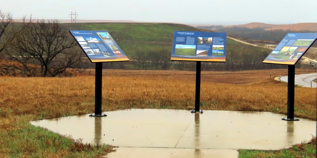
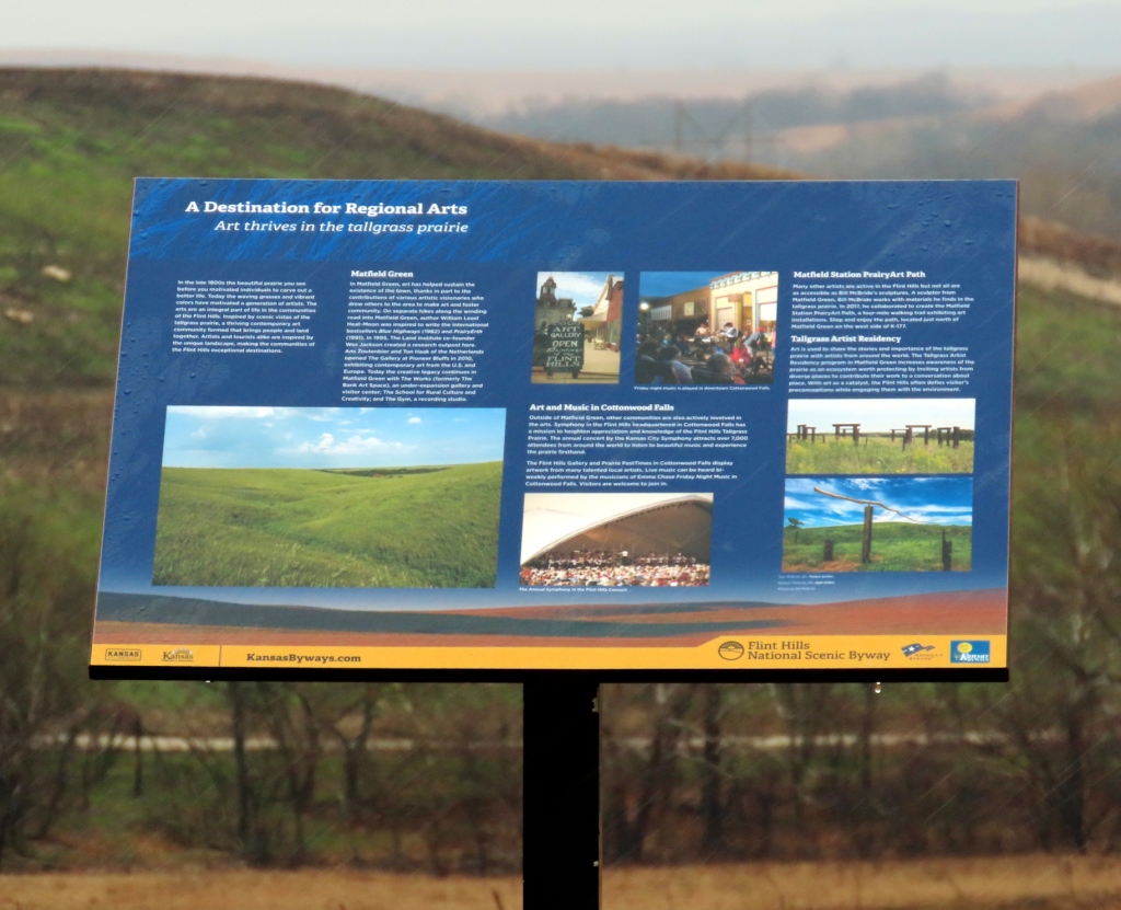
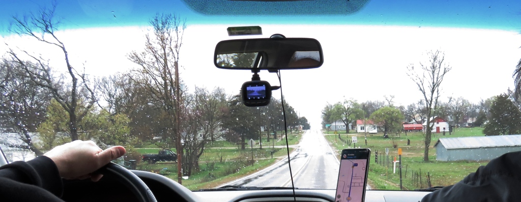
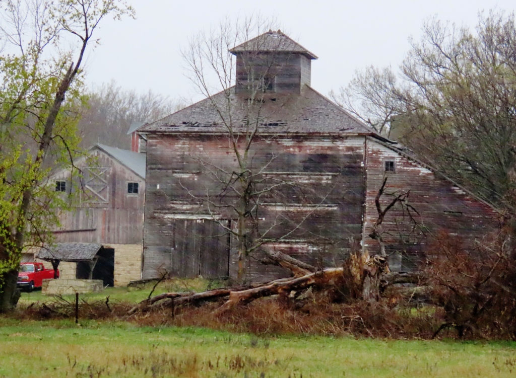
This entry begins and ends with towns that were not forgotten, Eldorado, Cottonwood Falls, and Strong City, although all of them probably have their glory days behind them. The towns in between, Teterville, Matfield Green, and Bazaar, struggling, ghost, or – in the case of Teterville – no longer even qualifying as ghost town. Most of these photos were from a rainy day trip. If it wasn’t for that I would have wanted to linger more. Especially for a closer look at those majestic range-roaming mustangs, the wild horses of these Flint Hills.

ELDORADO

El Dorado, Kansas (sometimes spelled Eldorado, one word. Usually by locals), named after that ancient ill-starred quest for gold. They searched for gold, but settled for oil. Settled in large numbers. When oil was first discovered northwest of town at the Stapleton#1 oil well on October 6, 1915 many more settlers flowed in from the east, in only three years more than tripling the town’s population to around 1000. By this time the Eldorado area had become the largest oil producer in the country. Yielding, according to Wikipedia “29-36 million barrels a day, equating to 64% of Kansas output and up to 9% of the national output.

Through the midcentury oil output was still respectable but in the seventy years since production gradually waned, going from almost two million barrels in 1966, from 939 wells to below 300,000 last year (2023) from 515 wells. The decline in oil production and the earlier decline in cattle droving are the main reasons for the shrinking or disappearance of towns in this area. Like mushrooms after a good rain they sprang up and, like mushrooms in the dry spell, they faded away.

Detailed information on yearly production of the El Dorado oil fields can be found here:
https://chasm.kgs.ku.edu/ords/oil.ogf4.IDProdQuery?FieldNumber=1000146901

TETERVILLE
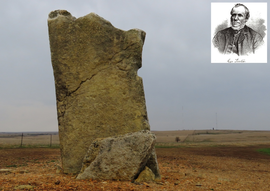
This monument is all that is left standing of the erstwhile oil town of Teeterville. And this is not even the original monument. The original, set up by James Teter (1849-1929) himself, was taken away and repurposed for other sites. This current monument seen here was set up in 1954.

This town came into existence in 1859 but really grew when oil was discovered around 1920. There were several houses here, two churches (Baptist and Methodist), several mills, a school, blacksmiths, general stores, and, in 1927, even a post office that stayed in business until 1962.
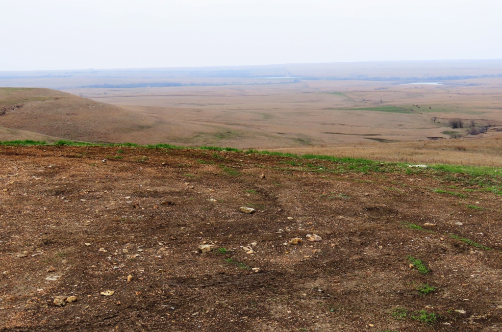
Above and Below: A fitting scene for the cowboy song “Bury me not on the Lone Prairie“. Well, I don’t know if any person was actually buried here. Maybe we could say a whole town was buried here. Or that it was snatched away as if a very thorough tornado made away with almost all remembrances of it.

These views are, respectively, to the east and south – as seen from the houses that used to be here. Seen from the air in Google Earth you can still see, mixed in with the loops of off-road vehicles, the faint straight lines of the town that was.

WILD HORSES
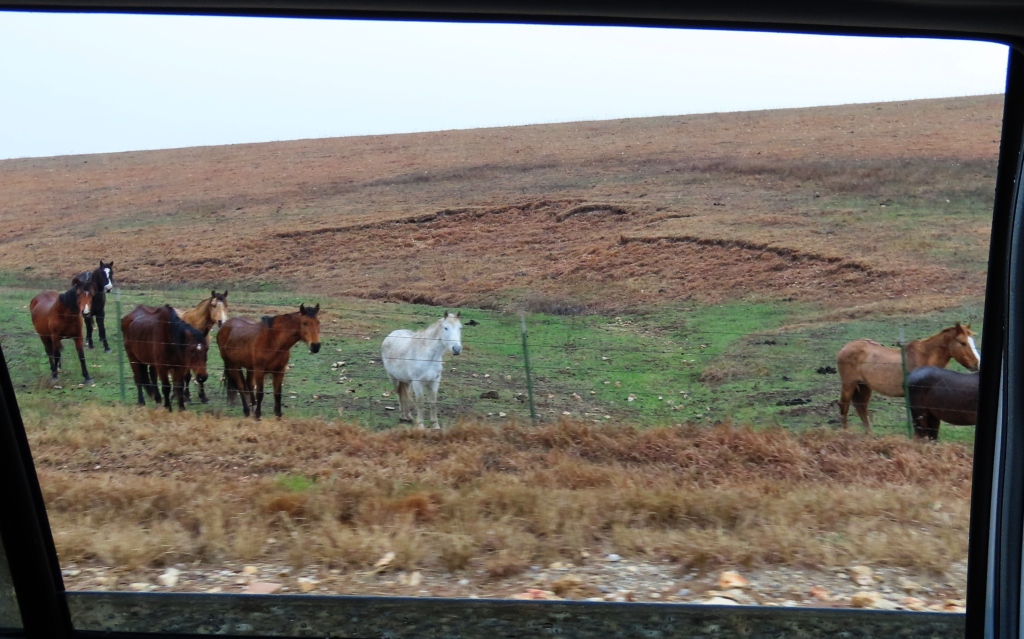
I was surprised with how many they were. And also that they did not seem particularly wild. They came readily to the fence line as we drove past, as if they were curious. In fact Steve Vestring, a local rancher, said, “We’ve had mustangs here for almost 10 years. After you’ve had them awhile, they gentle down. They’ll come up to us just out of curiosity.” More on this account can be found here:
https://www.travelks.com/kansas-magazine/articles/post/the-wild-mustangs-of-the-flint-hills/

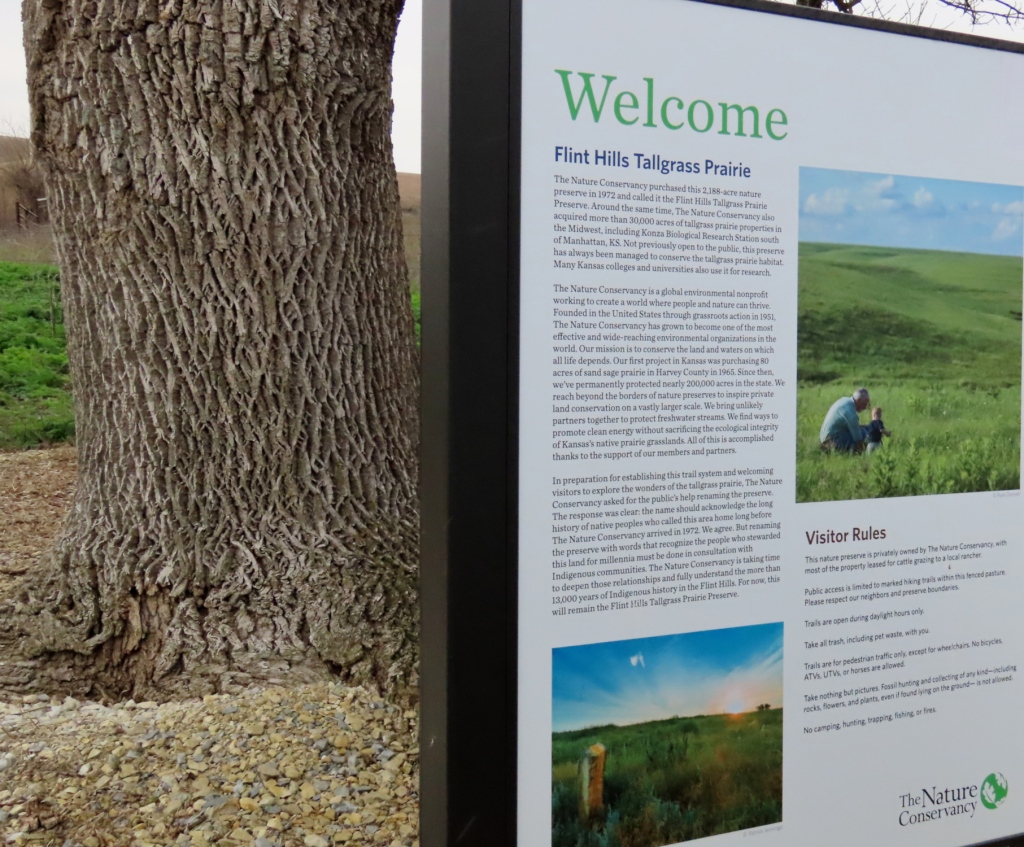
It may also be that they are hoping for handouts to supplement their usual diet of bluestem, buffalo grass, and other grasses. Most of these horses came originally from the BLM lands further west like Nevada and Wyoming.
The Nature Conservancy tries to balance environmental requirements with the realities of the human environment.

MATFIELD GREEN & BAZAAR

A view looking north, up Highway 177. If it wasn’t raining so hard I would have left the car for a closer shot. But I think you can read it once you select the picture.
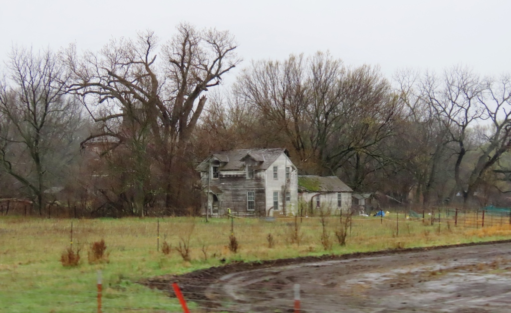
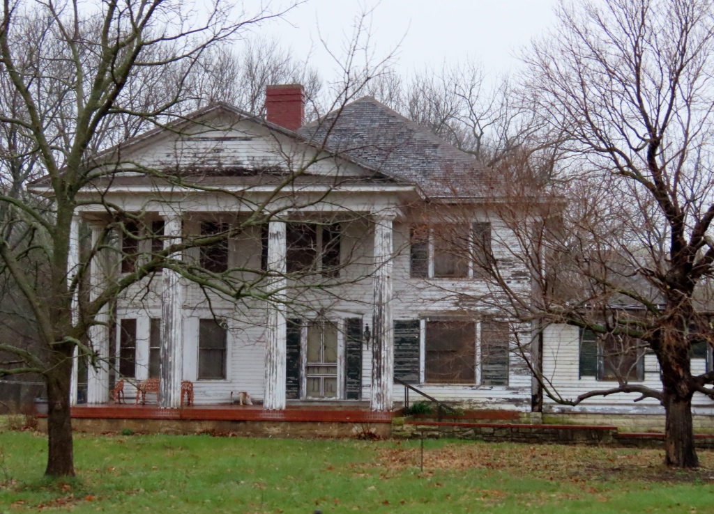
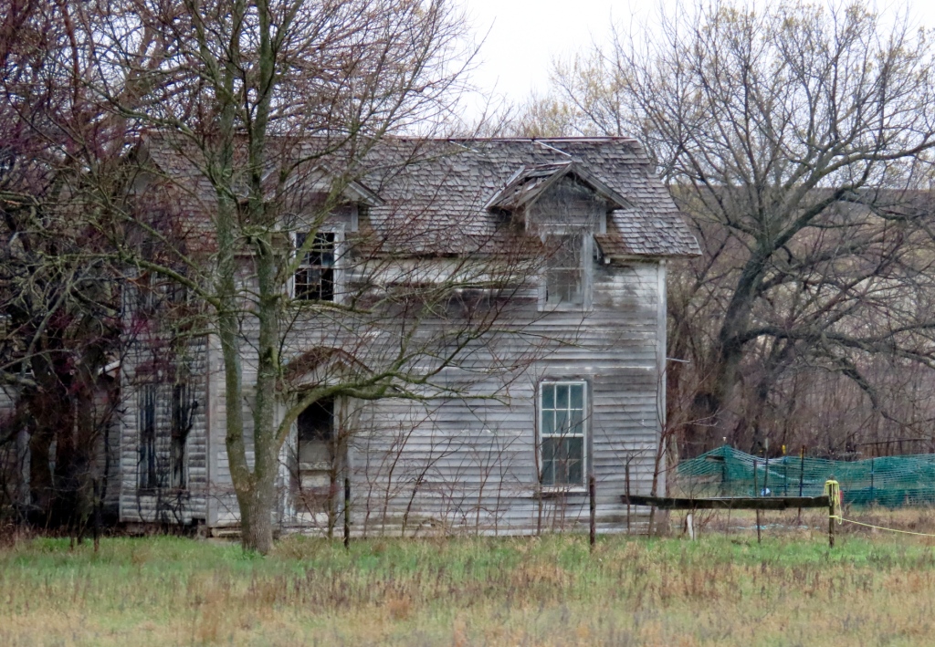
Going north on 177. The next four pictures may be out of order, making it hard for me to know which are Matfield Green and which are Bazaar. Let’s just label the next four photos: Dilapidated grand homes that have seen better days.
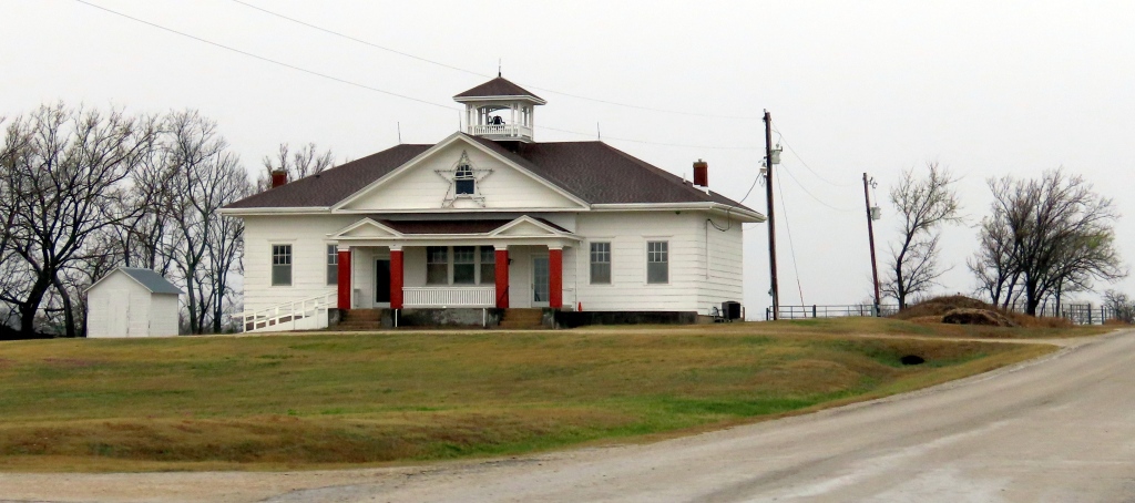
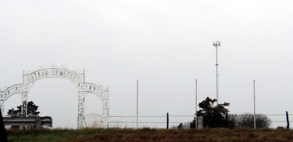
Above and Below: The schoolhouse and cemetery of Bazaar. They were side-by-side. Author William Least Heat Moon‘s PrairyErth has quite a bit of insight on this slice of Kansas. He recounts the reminiscences of Blanche Schwilling, the last postmaster – right up until the government, in his words,

closed down the p.o., took away the stamps, canceled the zip code, and said by its action that Bazaar was no longer a town” !

And many of the no-longer-townfolk agreed, seeing that the school (above) no longer operated. Yet Blanche refused to let the town die. She used the Methodist church building as her rallying point, ringing the bell, seeing to it that sermons were still given and, if a circuit preacher was not available – as was often the case – she offered her devotions.

COTTONWOOD FALLS
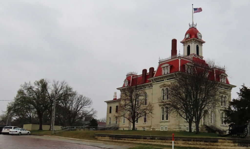
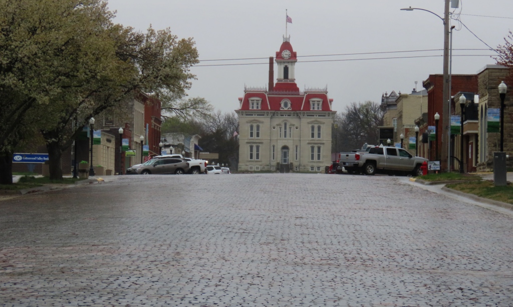
Above and Below: The Chase County Courthouse, built in 1873, although not the first in the state – that honor goes to the Ness City courthouse – it is Kansas’ oldest courthouse that is still operating. In a state with several striking courthouses I would say that this is the most impressive one I’ve seen. The red mansard roof and the large dormer windows almost makes this seem a European chateau or baron’s residence. My impressions, at least. This courthouse was a significant upgrade from the original one, built in 1859, which was a log building.
How are you going to keep them down on the ranch, once they’ve seen Cottonwood Falls?” Okay, I just made that up. But I can imagine that this town must have drawn some young folks from the much smaller Mattfield Green or Bazaar. This brings to mind another memory from Blanche Schwilling:

When Carrie Chandler lived down here, she jumped when she had a chance to move to Cottonwood, and someone asked, “But you’ll be buried in Bazaar, won’t you?” and she said, “I’ve been buried here long enough.
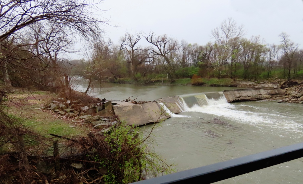
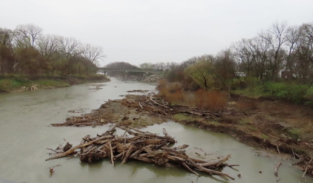
Two views, west and east, of the Cottonwood River. Zebulon Pike traversed this river (though maybe not this exact site) on his way westward.


STRONG CITY

Originally known as Cottonwood Station, in 1881 it was renamed Strong City after William Barstow Strong, then vice-president and general manager, and later president of the Atchison, Topeka and Santa Fe Railway.” – Wikipedia
In case you were wondering, yes, Barstow, California (formerly Fishpond, California) was also named after him. An improvement, don’t you think?
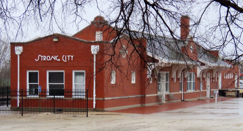
The ATSF Depot
Above: A neat attraction at the Strong City Kaboose Park is this train car. Below: You can even walk inside and examine the stove and sit down on the dusty padded seats.

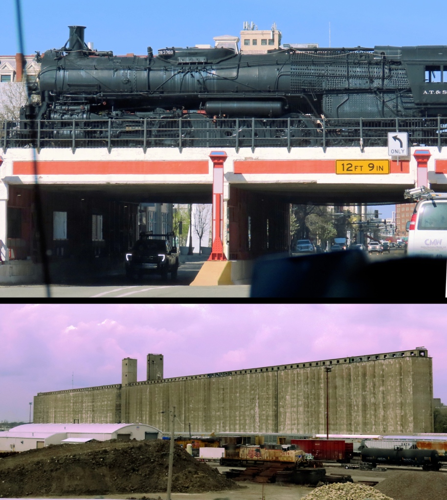
The railroad killed the cattle trails. And the trucking business later took a big bite out of the railroad business.

A little west of Strong City and running down from the north is Fox Creek. There is a well-known hiking area that meanders at times along this creek. Some of the terrain, once overgrown with brush and cottonwoods, is now private property, but a good part of it is in a nature preserve. Another area that, if I am ever up here again, deserves a good long nature hike.

I am sure it was a bit different 150 years ago, considering the following account. In the 1870’s, Zilphia, a single woman was living alone in a small cabin here near well-wooded Fox Creek when she was startled by a scratching outside her door. Timidly creeping over and peeping out, she saw the well-known – and wanted! – warrior, White Eyes. He asked to borrow a knife and she, afraid to say ‘No’, gave him the biggest knife she had. He noticed it was dull, but took it anyway. Weeks later, she again hears a noise by the door, a loud thump. There slumped against the door and, as Moon related in his book, “there lay a freshly killed deer, and thrust in it was her sharpened butcher knife.

CATTLE TRAILS & RUSTING RAILS

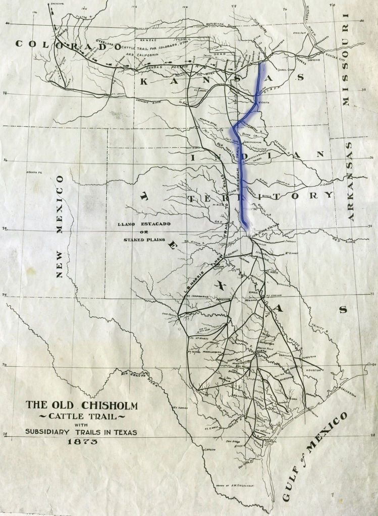
The Chisholm Trail (highlighted in blue) and other feeder trails. The Chisholm Trail started in Red River Station, now a ghost town, a few miles into Texas and originally ran all the way up to Abilene, Kansas, the cattle being transported eastward by rail. The trail for a long time was a lucrative venture, cattle prices at this northern end tripled over those in Texas. Demand in the east was high and the railroads reaching westward helped the transaction.

But all good things come to an end. The cattle trails were eventually made a thing of the past by two events, both were metal. The first was the earlier-mentioned railroads. As the lines continued being built west and southward the distance required for the drives necessarily lessened. Each new south-reaching rail line progressively shortened the cattle trails. The northern terminus of the Chisholm Trail went from Abilene to Bazaar (causing a temporary boom in economy) to Newton, Kansas, and then all the way down to Wichita.

The other thing was the impactive invention in 1874 by Joseph Glidden (1813–1906) of barbed wire, twined and twisted spiked wires that protected land owners’ increasingly large property from being trammeled by livestock and drovers coming up from Texas. In twenty year’s time they put an end to the open range era. These two events, both of them metal strands, put an end to the cattle drives and, with that, shortened the “cowboy” years of TV westerns to only about twenty–five years.

And then the railroads themselves lost their preeminence, as the trucking industry proved a more economical means of transport.

The towns here are small in size now, but rich in history.

Three Weeks in Kansas and my Hometown -Wichita

I suppose it is a trite saying that home is where you hang your hat. Well, I guess that is true of Wichita, Kansas. It feels pretty much like my hometown having, come to think of it, lived here at least part of all (nearly) seven decades of my life. I have family and friends here. It is pretty laid-back. And I like the nature here.

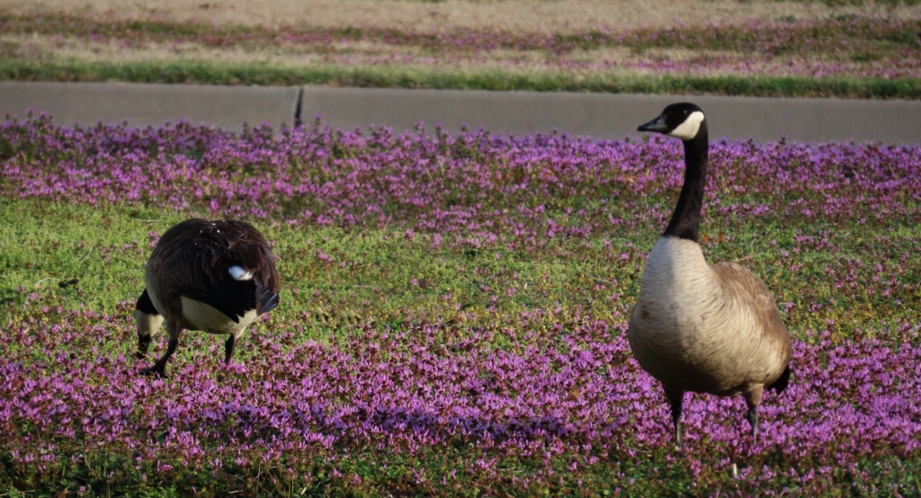
Speaking of which: My two favorite places to get my “Wildeinsamkeit” are, left, Sedgwick County Park on the city’s west side and, right, Chisholm Creek Park on the north side. Most of my Wichita nature photos here are from those two places. Well, except for one of the Canada Geese on a lawn. Those feathered beasts are everywhere. Watch where you step!

By the way, the usual German word is “Waldeinsamkeit” (“forest solitude“), but no place in this area qualifies as forest, so I settled on the “wild” part.

A Walk in the Park

Left: This Dwarf Russian Almond, Prunus tenella, is not native to America but is often planted as a winter-hardy ornamental. Center: Chisholm Creek Park has good signage as well as plenty of places to sit and wait for the wildlife to come to you. Or, as my wife and sister did, you can just go out on the wooden bridge and feed the ducks, turtles, and opportunistic carp. Right: Smooth Sumac, Rhus glabra, not looking very vibrant in this cold season, makes a delicious lemonade-drink. This is one of the three “lemonade sumacs” that occur in the Wichita area. Unfortunately, this was the wrong time of the year or I would have been tempted to snap off one of those heads. For those who do try this it is important to first strain the fruits through a cheese cloth (or a tee shirt that you don’t particularly care for!)
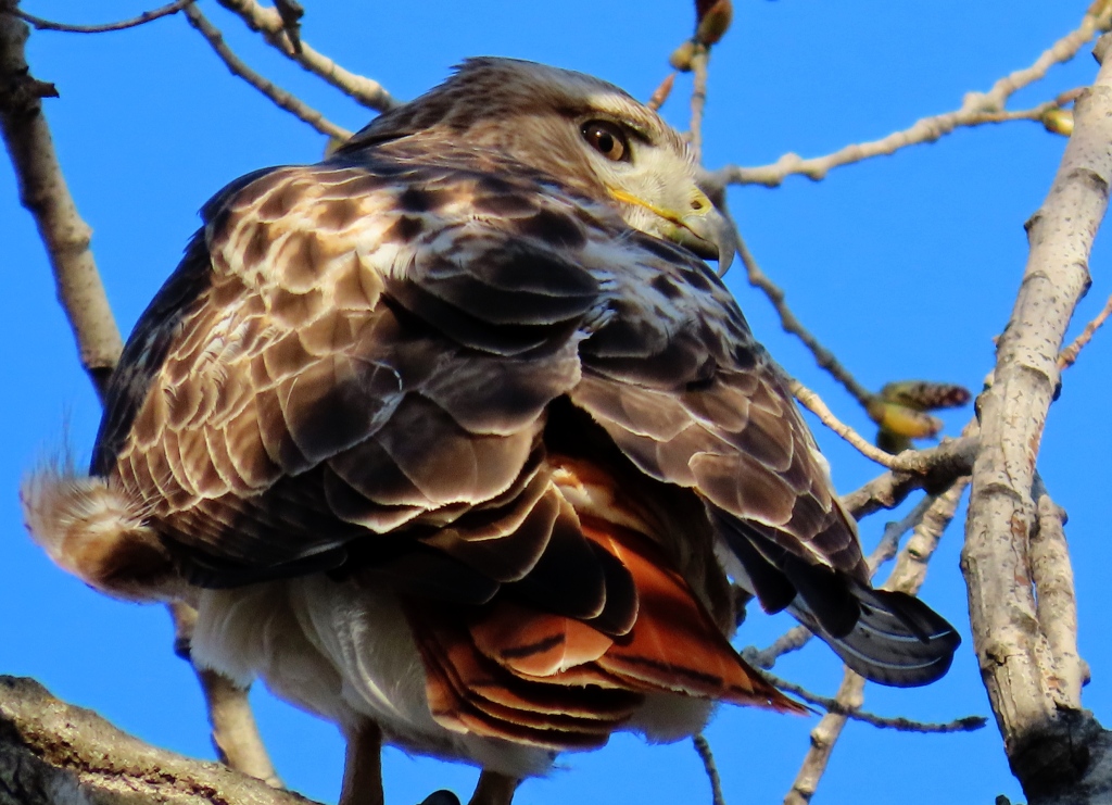
Red-tailed Hawk, Buteo jamaicensis. By far the most common raptor in the area. It is often unfairly saddled with the name “chicken hawk” though that name fits better (though only slightly) with the Cooper’s Hawk. I am quite happy with this photo. You can select it for a better view.
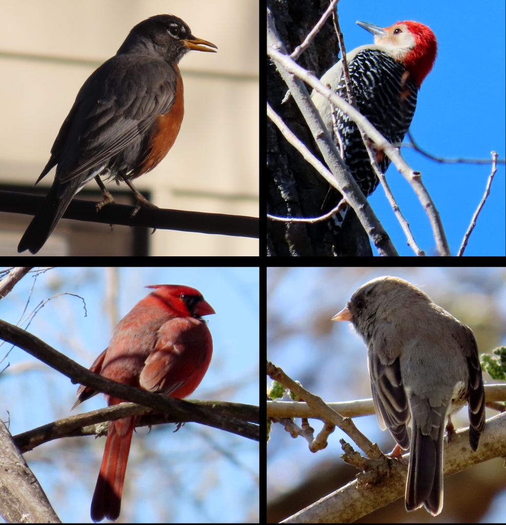
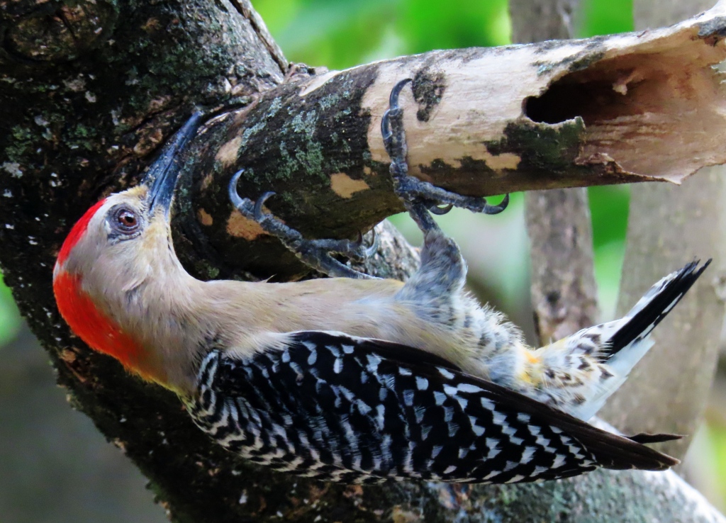
Top Left: American Robin, Turdus migratorius. This photo was taken in my brother’s backyard on the very day my new camera came. I was itching to try out the settings and the bird obliged to have his portrait taken. Top Right: Red-bellied Woodpecker, Melanerpes carolinus. I think a better name would have been “Red-capped Woodpecker” since the red on the belly is faint and not often visible. Bottom Left: Northern Cardinal, Cardinalis cardinalis. Bottom Right: Dark-eyed Junco, Junco hyemalis, also known as the Snowbird. It might seem silly or pretentious to add all of those scientific names with these very familiar birds but they are not familiar to everyone. I have readers of this blog from around the world, one who asked me to always give the Latin names as well.
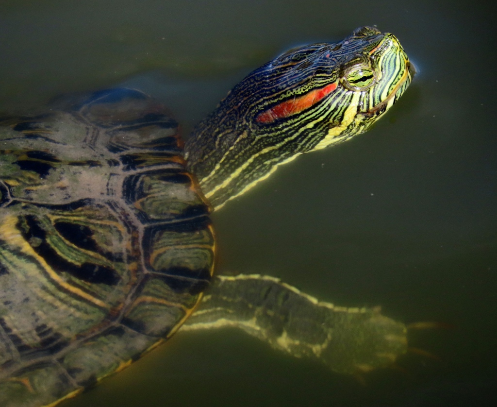
The Pond Slider, Trachemys scripta, native to America and Mexico is, believe it or not, a troublesome invader in other parts of the world. They out-compete many native species wherever they spread, in most cases having been released as pets. They sometimes eat bird eggs and (according to one source) even hatchlings. I have seen them often in parks in Europe, Northeast China and Southeast Asia.
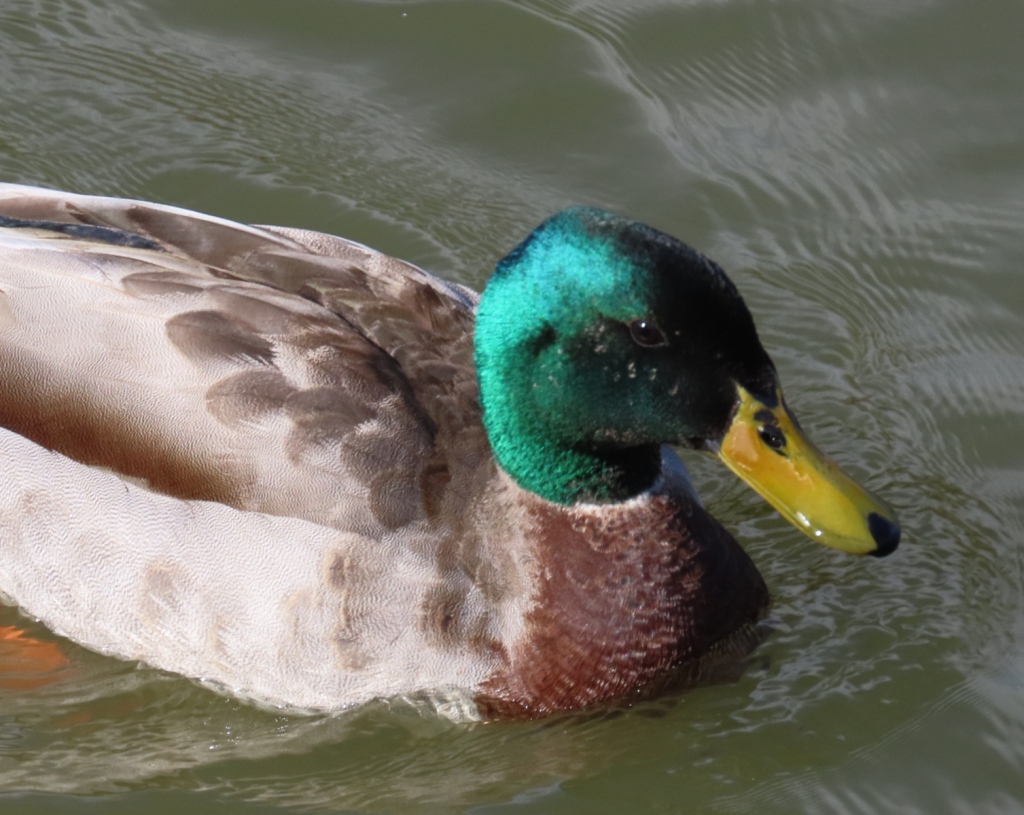
Mallard, Anas platyrhynchos
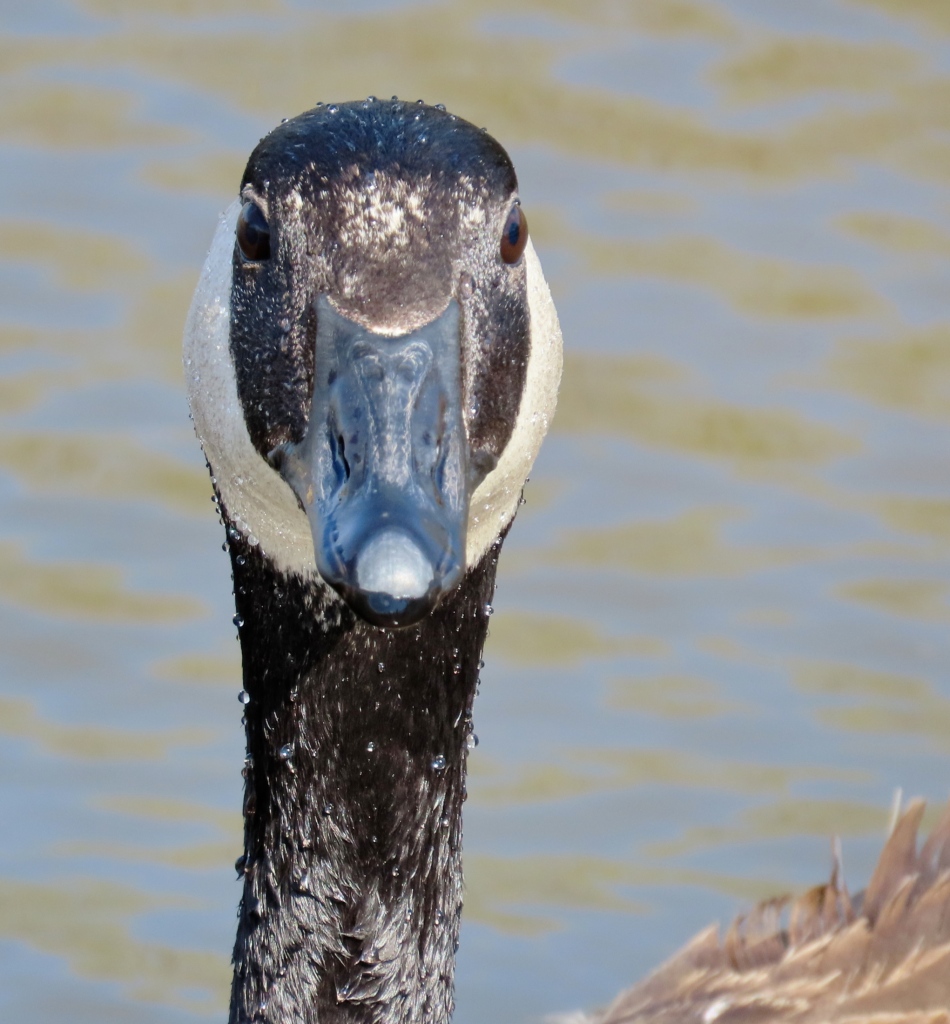
“What are you looking at?” Canada Goose, Branta canadensis. These last two birds are the most commonly reported birds of Sedgwick County, Kansas, largely a reflection of how common they are throughout the city of Wichita. Lawns, driveways, parking lots – not just parks and rivers – are all fair game for these birds.
These geese are feeding on Henbit, Lamium amplexicaule, a plant that covered many lawns the weeks we were here. The owners may not like it but I thought the combination of purple and the bright yellow of dandelions was more impressive than boring grass. The plant has many uses, culinary and medicinal.
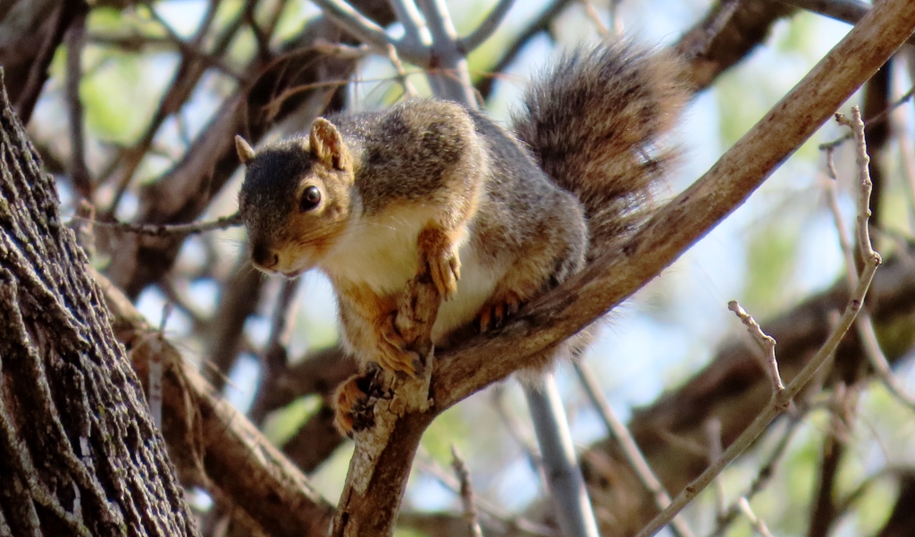
Fox Squirrel, Sciurus niger
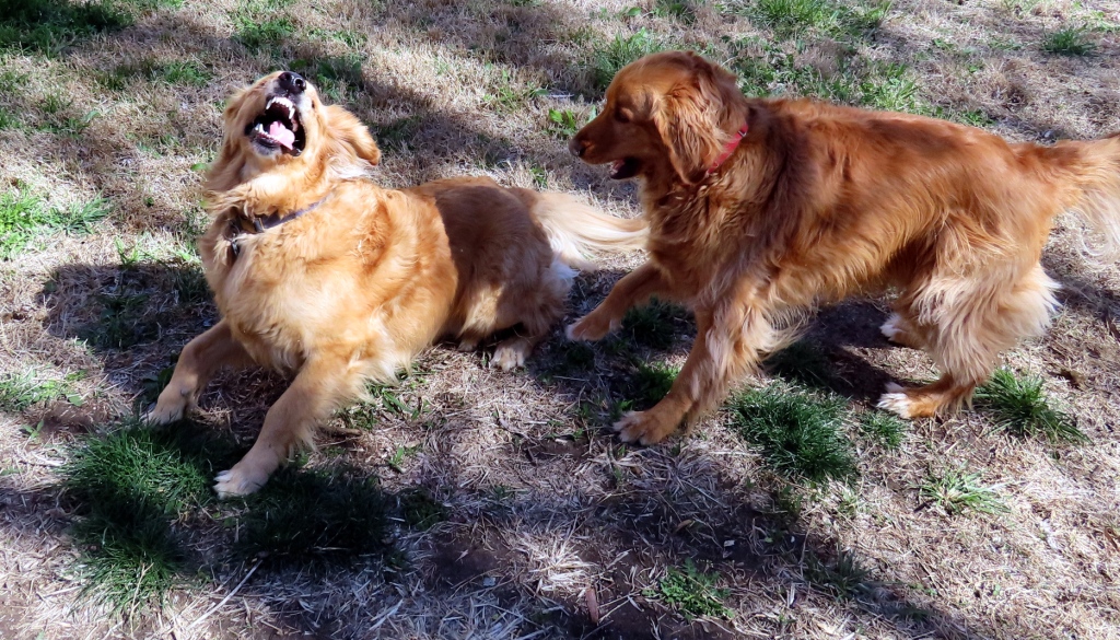
When the dogs aren’t chasing those squirrels they are getting rambunctious with each other.

Riding Around Town

Left: Steel statue of the bison that are no longer around these parts. I must say that the art pieces around town are a lot more interesting and varied than they were back in the 60’s. All I remember is that ghastly Tripodal parked like a crouching alien ready to spring onto the Century 2 building. Right: Exploration Place.
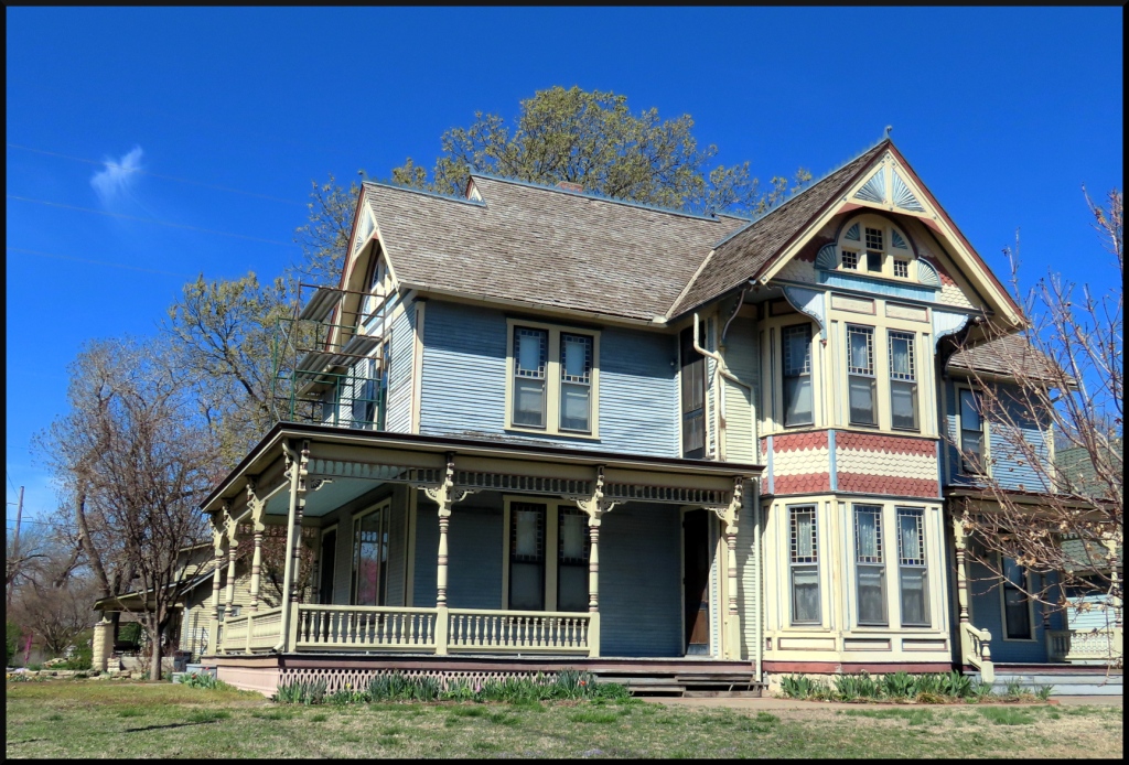
This beauty gem of a house is on the corner of Martinson and West 2nd Street North. The older sections of Wichita still have houses that retain the old style of architecture, but none as striking as this one.
Left: Downtown and the Arkansas River (Here pronounced “Arkansas”) Center: Sedgwick County Historic Courthouse Right: Looking north on Main Street. The old building on the right of the street is the Wichita Sedgwick County Historical Museum built 1890. It used to be the courthouse. I had to pay a fine here back in 1972 of 5 dollars for jaywalking.
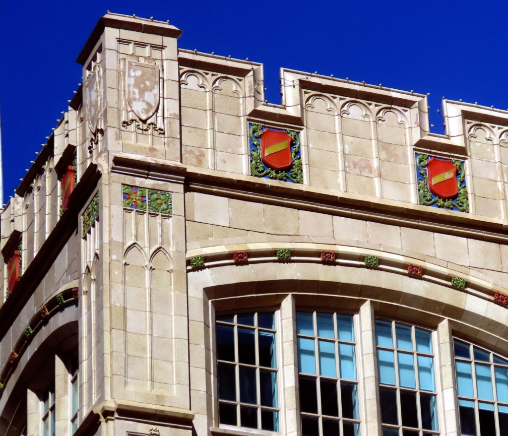
Detail of the stately Kresge Building on Douglas Avenue.
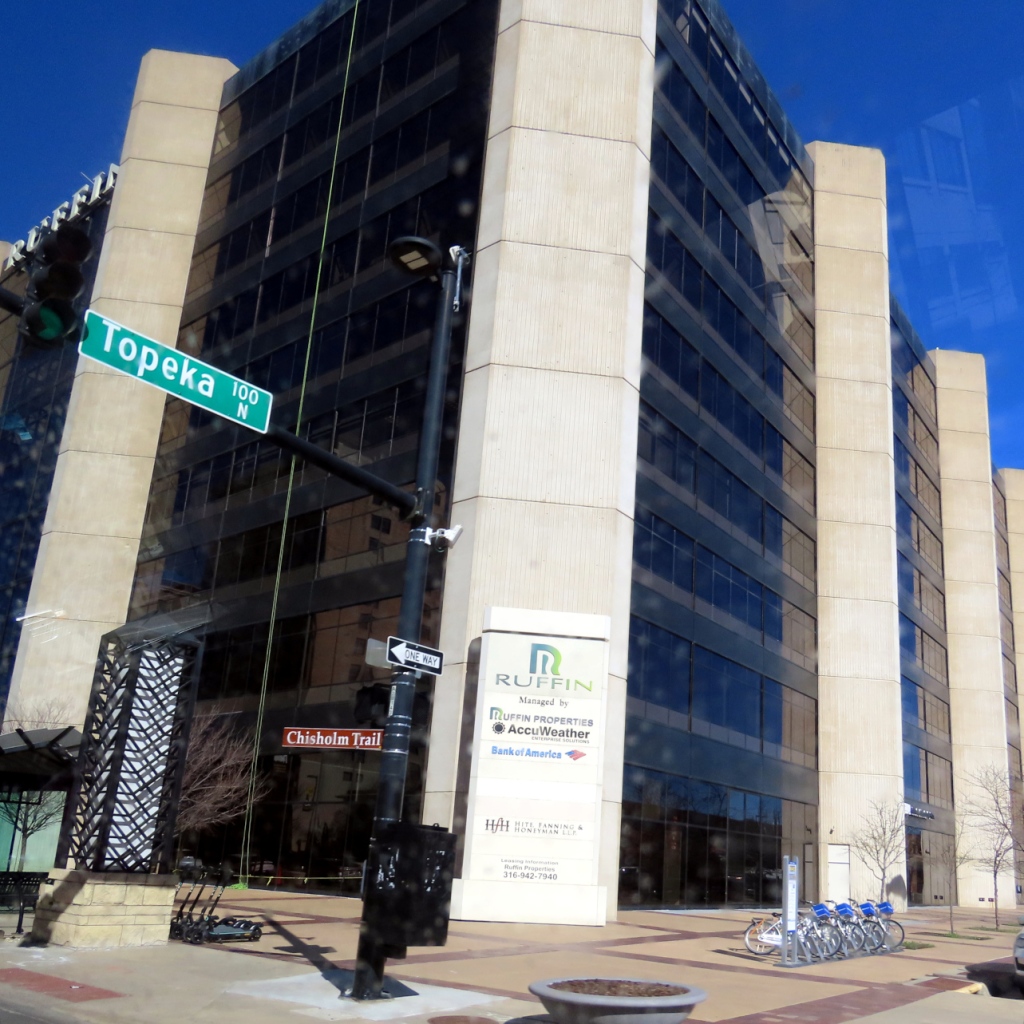
Also on Douglas Avenue, across from the Kresge Building, is this building that used to be a bank. Not sure what it is now. As the brown sign indicates, this was part of the Chisholm Trail. Cattle were driven through here northern Texas all the way up to Abilene, Kansas. More on that later.

Next: Eldorado and wild horses of the Flint Hills!

Dominican Detour

On our way northward from Colombia we decided to spend twelve days in the Dominican Republic.

Once again, since we are in a hotel with wobbly wifi, this will be a short post with a few photos and comments. We are enjoying our stay here and it seemed a shame not to write something. And to share a few phone photos even though my main camera died on me back in Santa Rosa de Osos, Colombia. (I hope to get a new camera in a week or so).

The following photos are from the three main places we stayed at or visited: Santo Domingo (photos need uploading), Juan Dolio, and San Pedro.

SANTO DOMINGO

I’m assuming its election season coming up.
Part of the south facing fortifications of the city has been joined to the Malecon (Riverside Promenade) which makes for a pleasant breezy morning walk. Tranquil, too, if you can ignore the loud, busy traffic on Avenida George Washington. For this photo I shot an angle where you don’t see the mostly plastic litter washed up on the lower rocks, nor the man down there doing … something.
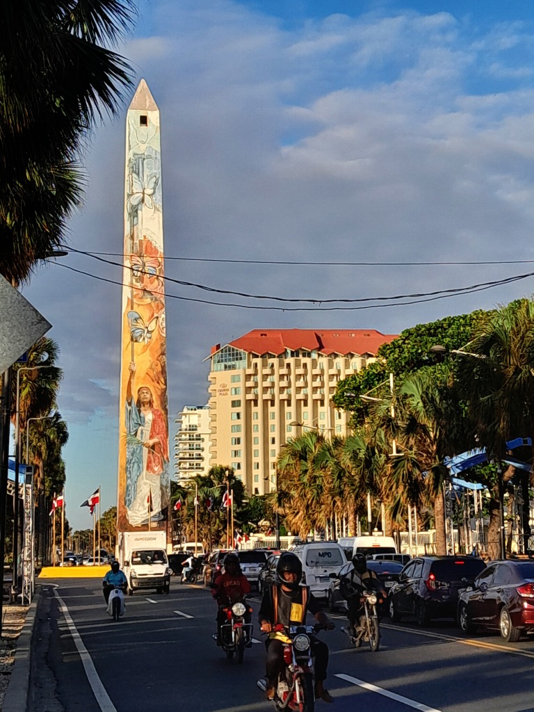
Santo Domingo, like several Latin countries, has its obligatory obelisk. This one is prettier than most, painted on all sides with national motifs and persons.
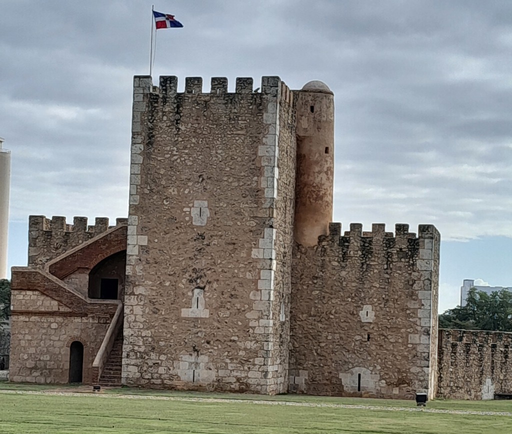
Sixteenth-century Fortaleza Ozama fronting Calle de las Damas protected the river entrance to the city.
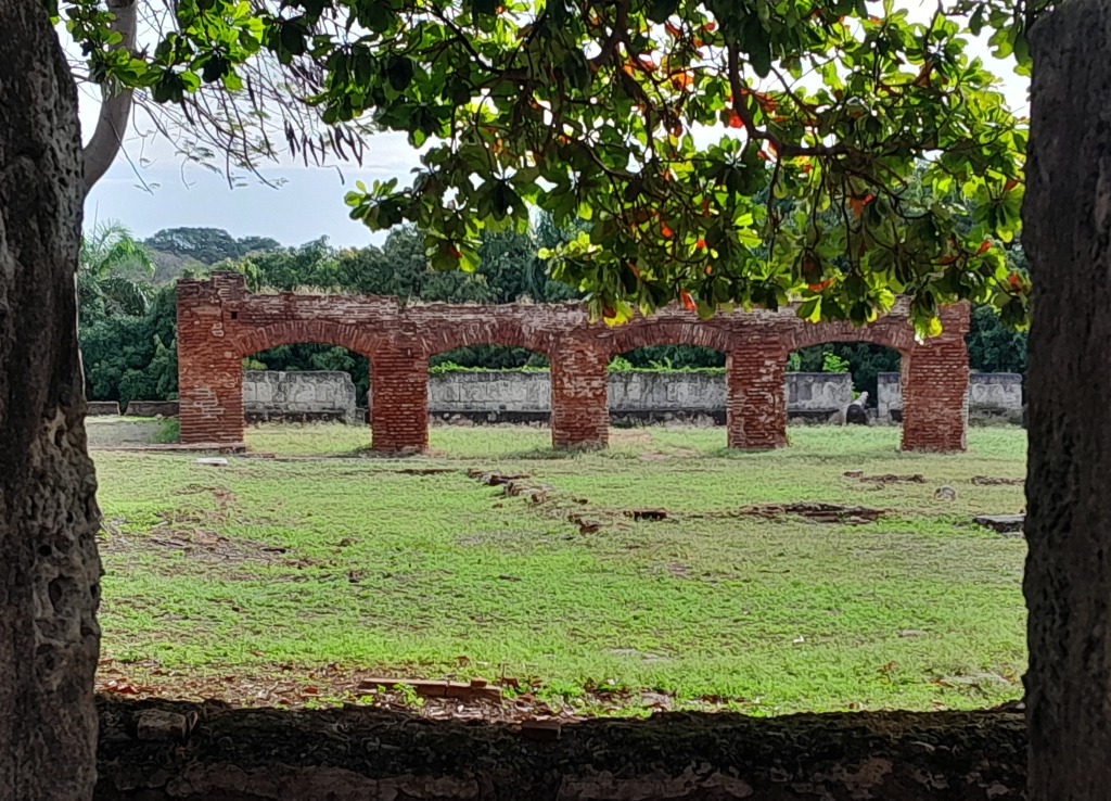
Part of the fort-complex. It is just south of the Powder House but I could not find out what its purpose was. Maybe these were stables?
The next three images are of the Parque Independecia (What Mexico tends to call a “plaza” the Dominican Republic and Colombia refer to it as “parque”). This crosswalk was really difficult. Busy traffic and, unlike some countries, the city folk here were not particularly courteous. But on one occasion a policeman was there.
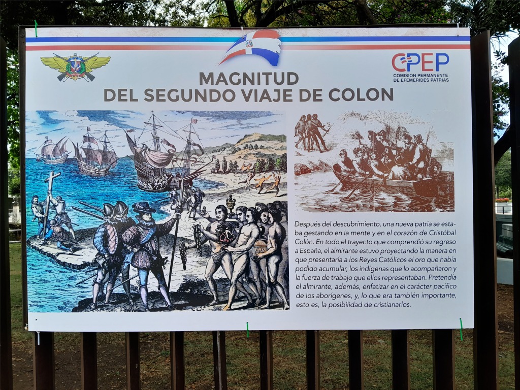
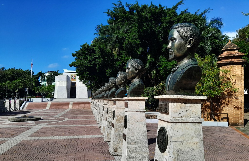
Important persons of the city and country. More interesting, to me at least, were the helpful placards ringing the the whole park – there most have been dozens of them – with maps, diagrams and short vignettes of the country’s history. Very informative. I should have taken more photos but my stomach was growling.
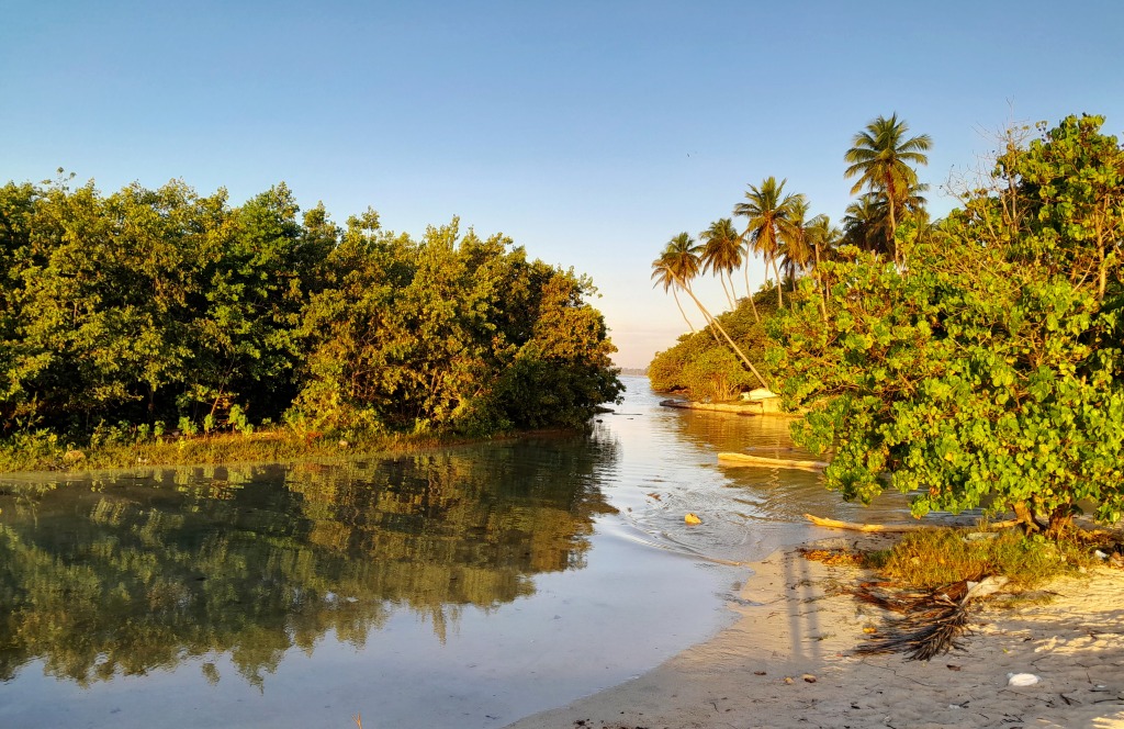
Queen of the Angels Orphanage School
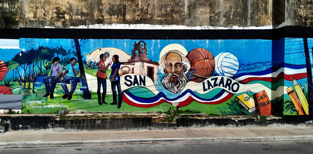
San Lazaro (St. Lazarus of the Bible). He is the most venerated saint among Roman Catholics in Cuba. Interesting, though incongruous, items all crammed together.
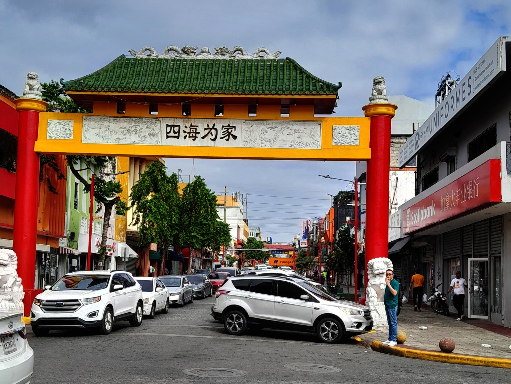
Chinatown, not as large as some Chinatowns (like San Francisco or Bangkok) but – within its limits, basically two blocks – very Chinese. Having spent five years in northeast China most Chinatowns have failed to satisfy my craving for true Dongbei (Northeast) China food.
Market adjacent and running into Chinatown. Cabbage-pecking Chickens, chives, carambola (star fruit), limes, breadfruit, and who knows what else.

SAN DOLIO

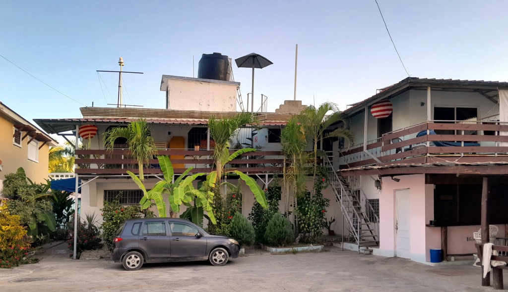
This town had a definitely more relaxing vibe than boisterous Boca Chico. Vibe. Now there is an overused word. My wife and I tend to do an end-run around vibe-y areas. This is where we stayed.
Lots of places to explore up and down the coast from our guesthouse, as you can see by the photo above and following.
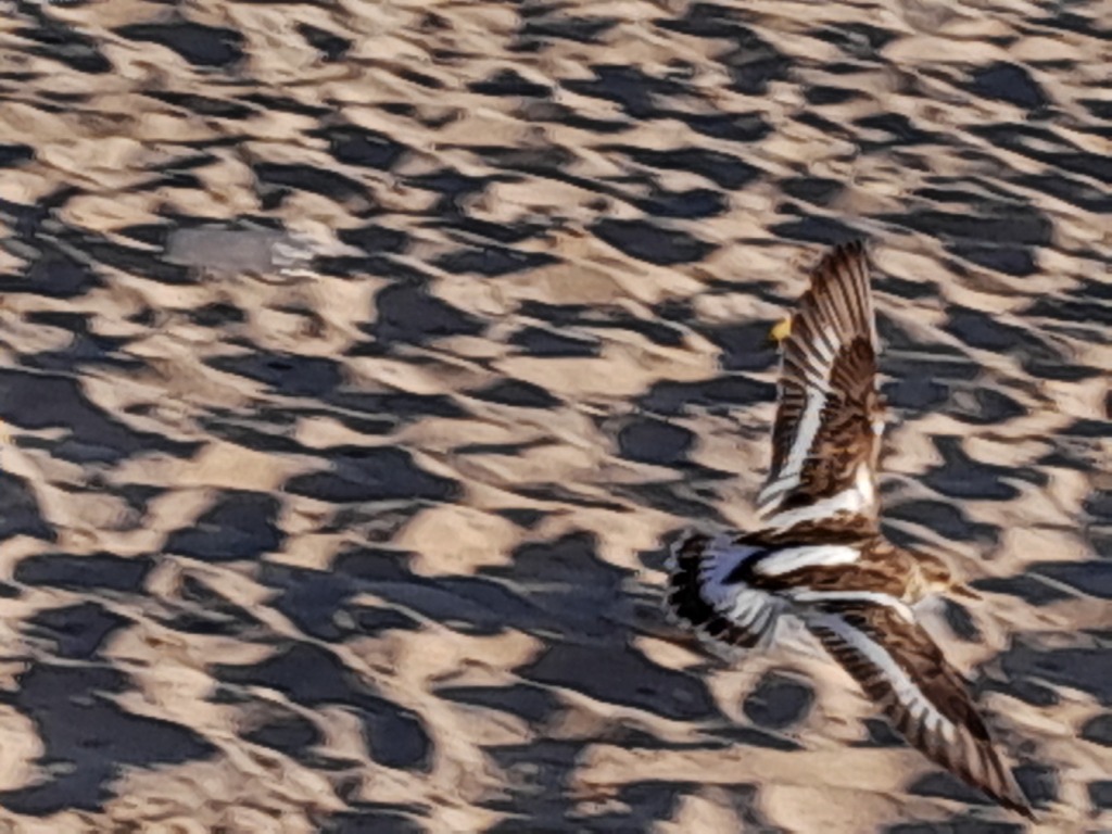
Ruddy Turnstone. This probably the best of my poor to middling phone photos of wildlife.

EDIT: I was frustrated by no longer having my telephoto camera, a Canon PowerShot SX70 HS. I liked my old camera so much I finally, here in Kansas, bought the very same model again!
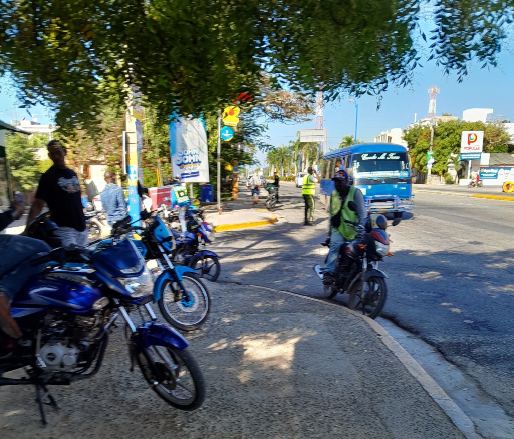
Waiting for the bus to San Pedro. We passed on those two wheel taxis.


SAN PEDRO DE MACORIS

A tight squeeze for the twenty minute ride to San Pedro.
The market in San Pedro spills over onto adjacent streets.

Colombian Beauties: Brilliant Birds and Other Animals

We have been here in Colombia for almost a month, slowly wending our way from Bogota northeastward with a general goal of maybe flying out from Cartegena, Bucaramanga, or whatever seems feasible. It has been an enjoyable trip. Especially after leaving Bogota, events there in the news made us a bit leery of lingering.

After That we made our way to Tunja, Duitama, San Gil, Barichara – Thank you kind lady sitting next to me on the plane coming down for telling me about this gem of a town! – and now we are in Giron, also a colonial white-walled town similar to Barichara, but somewhat grittier.

I have been so occupied with exploring these towns – and also my other writing projects – that I neglected this blog. Since I have so many good nature photos accumulated that seems like a way to remedy my publishing hiatus here. Below are some of the Colombian beauties we saw, mostly birds:

Left: Carib Grackle, Quiscalus lugubris, Bogota. He sings better than his Mexican cousins. Center: Glossy Flowerpiercer, Diglossa lafresnayii, caught in the act of piercing a flower! La Zarza, near trinidad. Right: Central American Agouti, Dasyprocta punctata. San Gil.
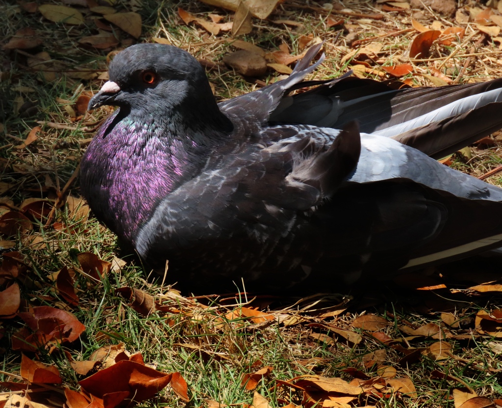
The Rock Dove, Columba livia. Pigeons, especially when the light favors them as here, can be quite striking. Barichara.
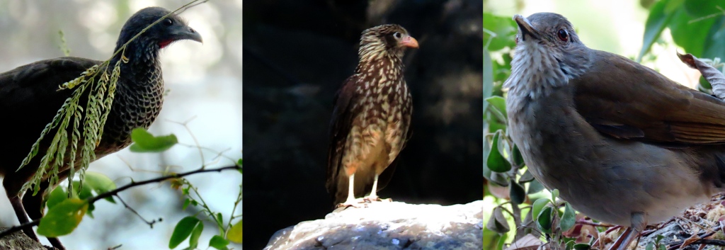
Left: This Colombian Chachalaca, Ortalis columbiana, was the first bird I saw as we arrived in San Gil. Raucous birds, especially when they get together, but always fun to watch. Center: Immature Yellow-headed Caracara, Milvago chimachima. San Gil. Right: Pale-breasted Thrush, Turdus leucomelas. San Gil.
These next twelve photos are all from Barichara, Colombia, a mountain town just a half an hour’s bus ride from San Gil. Close by, but quite different. Peaceful, touristy yet not overwhelmingly so. We spent about ten days here. And each day there was a different part of town and countryside to explore.
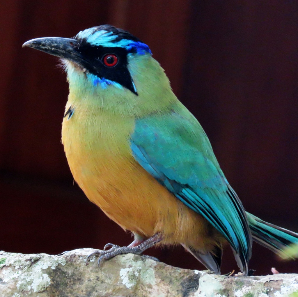
The names of these motmots are in a constant state of flux, it seems. As of this week, at least, this is the Whooping Motmot, Momotus subrufescens. Beautiful birds, whatever the name.
Left: Tropical Mockingbird, Mimus gilvus. Center: Blue-and-white Swallows, Notiochelidon cyanoleuca, make themselves at home under the eaves of the colonial houses. Right: Bar-crested Antshrike, Thamnophilus multistriatus.
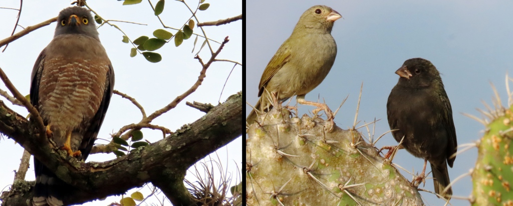
Left: Roadside Hawk, Rupornis magnirostris. . I have never seen so many of these hawks in one place as I have here in Barichara, especially along the cliffside that marks the north edge of town. Right: Black-faced Grassquit, Melanospiza bicolor
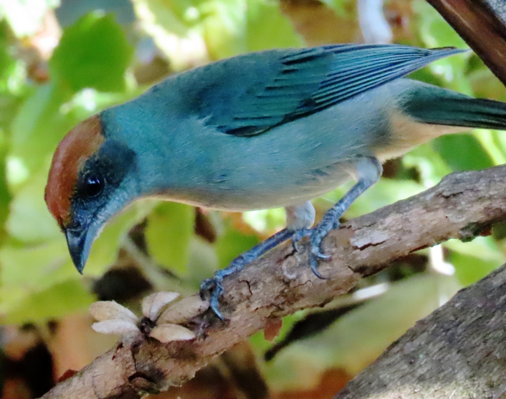
Scrub Tanager, Stilpnia vitriolina. This striking gem of a tanager was a frequent visitor to the courtyard garden of our guesthouse, allowing me to get a decent photo from our window.
Some familiar friends from further north, Mexico and the Southwest states of the US, respectively. Left: Chestnut-capped Warbler, Basileuterus delattrii. Right: Vermilion Flycatcher, Pyrocephalus obscurus
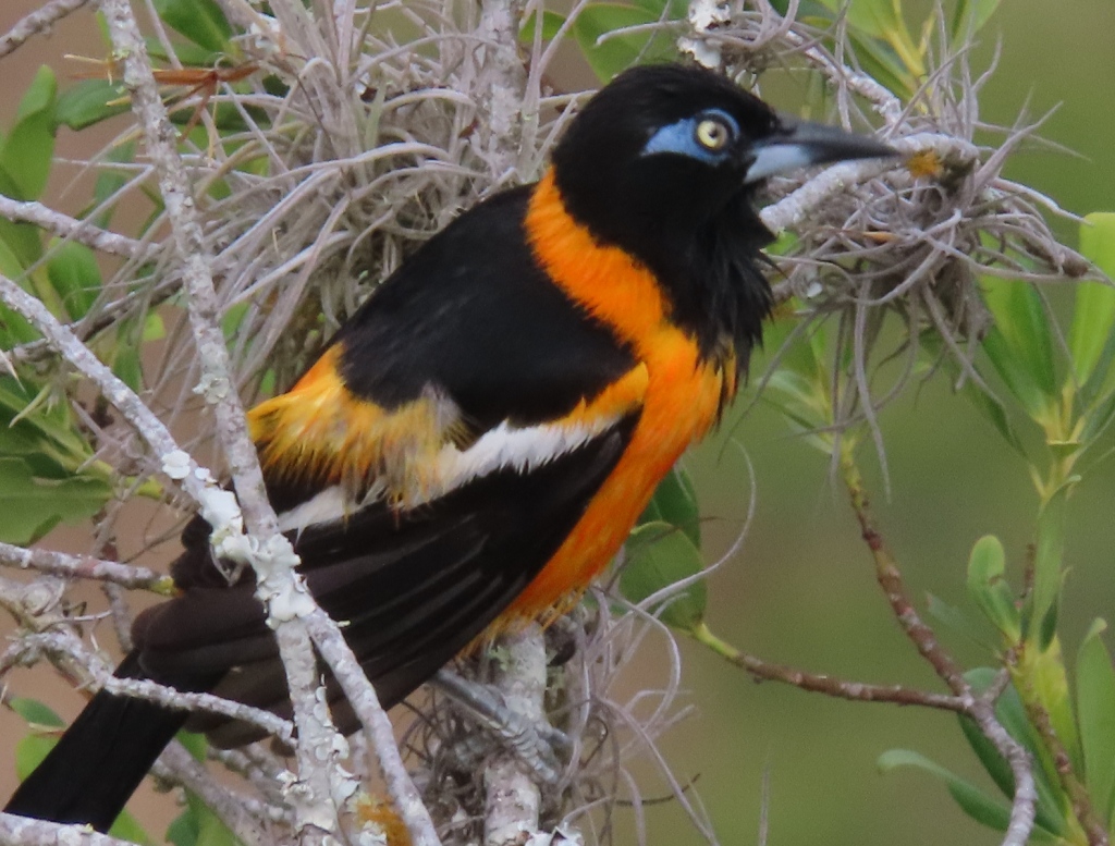
Venezuelan Troupial, Icterus icterus. They look a bit like Orioles of the Baltimore persuasion, but they are not nearly as “well-behaved” as their northern cousins. They don’t build their own nest, but take over other nests, abandoned or occupied. If the nests are occupied they push out or – in some cases – eat the eggs and nestlings and then settle in to their new home!

This fellow sang such a nice, fluty song. But the blue robber-type mask gives him kind of a lean and hungry look!
Left: Yellow-olive Flatbill, Tolmomyias sulphurescens. Right: Spectacled Parrotlet, Forpus conspicillatus. These little parrots, once they light into the trees are very hard to pick out from the leaves around them. The second morning that I saw these birds they were working over the Müllerian bodies (“Gummi Fruit”) of a Cecropia Tree.

All the photos below are from Giron, a town just a few kilometers outside of Bucaramanga.

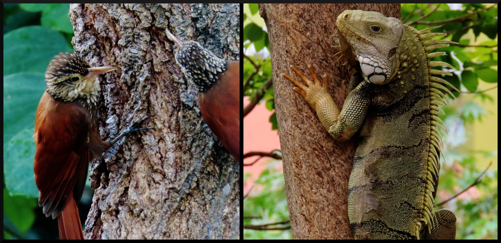
Left: Straight-Billed Woodcreepers, Dendroplex picus, are pretty common on the far bank of the stream. Right: Green Iguana, Iguana iguana. And these are especially common on the near side of the stream, along the aptly-named Parque las Iguanas. It is “las Iguanas” because they are fed here with fruits and vegetables from the nearby market. I noticed that they left the carrots untouched.
Left: One of the most unusual bird calls among the wrens is that of the Bicolored Wren, Campylorhynchus griseus. Center: The Spectacled Parrotlet, Forpus conspicillatus, like the other parrotlet above, is hard to see – even with the male’s pronounced eye-ring and wing margins. Right: Red-Tailed Squirrel, Sciurus granatensis. I would just call it Red Squirrel, but that name was already taken by a North American squirrel.
Two feisty and very successful competitors are these two colorful birds. Left: The Blue-Gray Tanager, Thraupis episcopus, is especially aggressive. Right: I have not seen the Saffron Finch, Sicalis flaveola, actually chase away other birds like the Tanager has. They are probably just successful because of environmental degradation. But both of these are very photogenic, don’t you think?
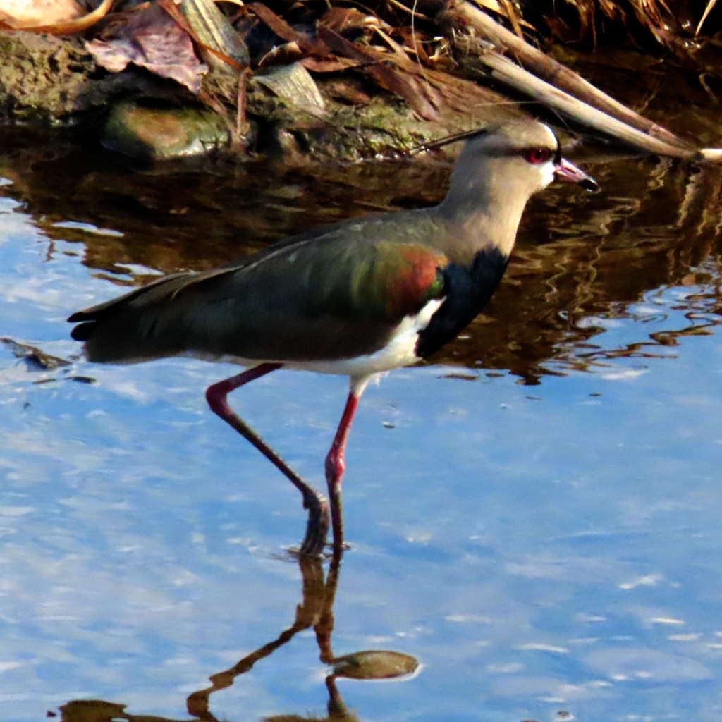
Southern Lapwing, Vanellus chilensi.
Red-crowned Woodpecker, Melanerpes rubricapillus. One of those birds that is usually first heard, then seen.

I hope to write more next time about the towns that we have visited this last month, especially Barichara and Tunja. Hopefully in a few weeks. Or maybe I will finish my set on Africa and start writing about our Malaysia adventures.

A Pleasant Visit to George, South Africa

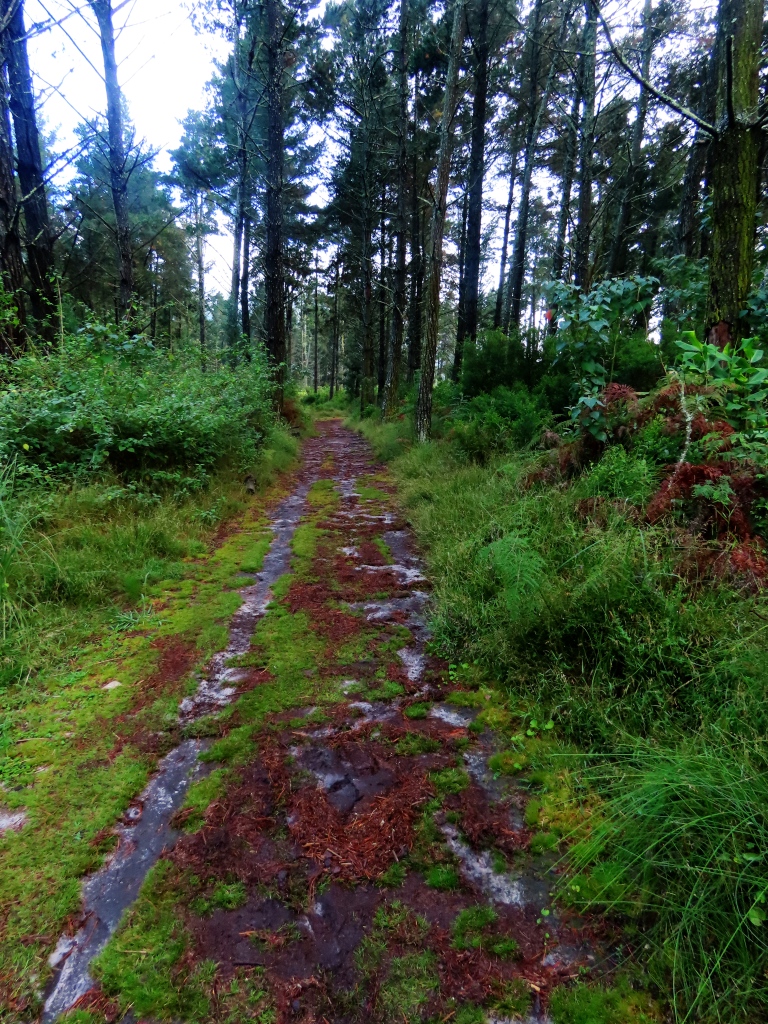
We had never heard of this city before coming to this country Now we will not forget it. We had a very pleasant stay here, as well as in nearby Knysna (pronounced “Nice Nuh”. You’re welcome!). There are plenty of birds and other animals as well as peaceful nature walks in these two towns. This article will be about the first town.

But first a few photos and comments about the town itself. The photos, as with all of my articles here, can be selected for a better view.

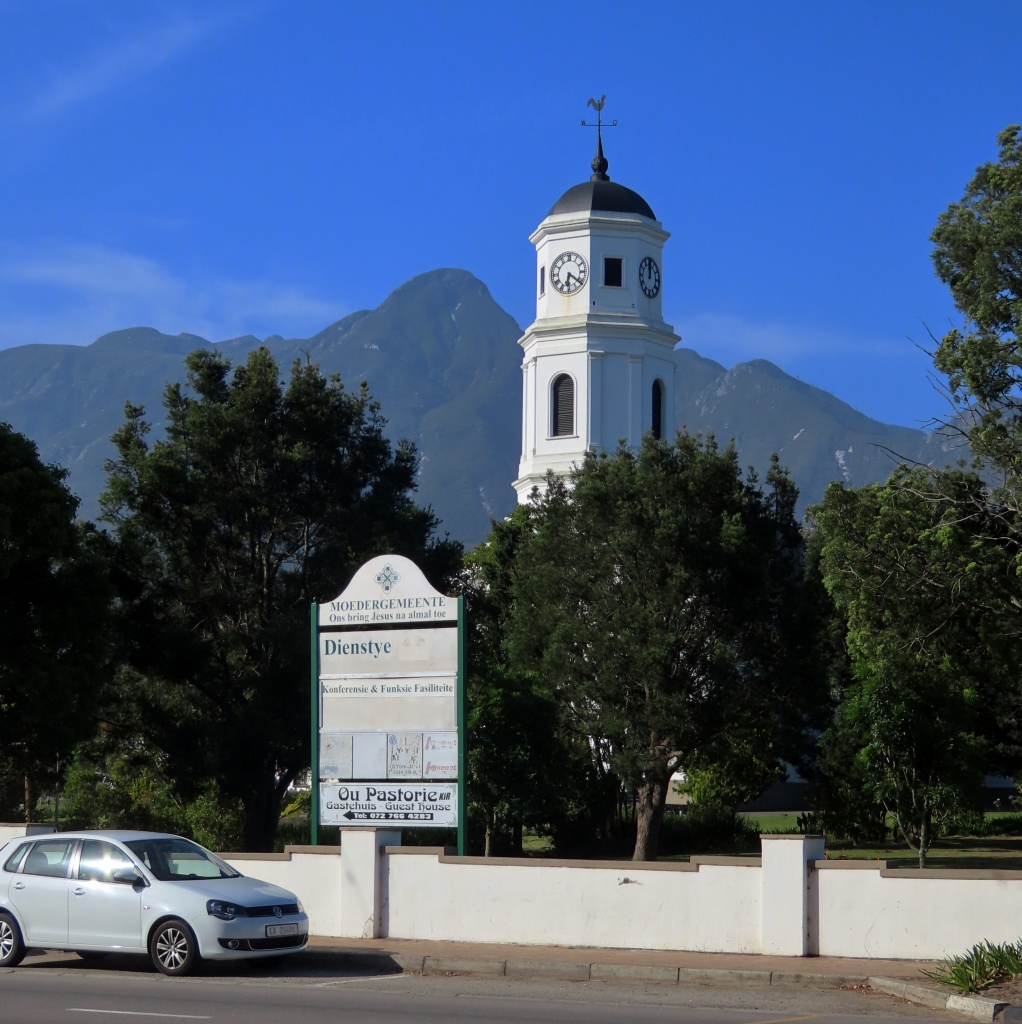
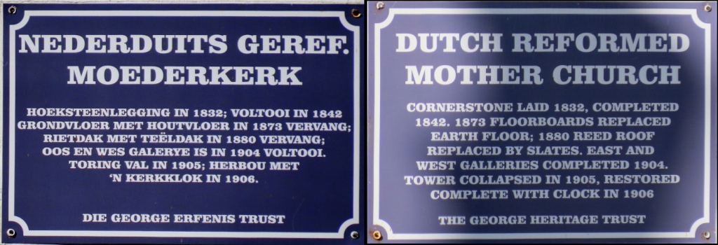
Dutch Reformed Mother Church. Some history for this church is in the next photo. (I like the dual-language signs. They help me to learn the other language.)
binary comment
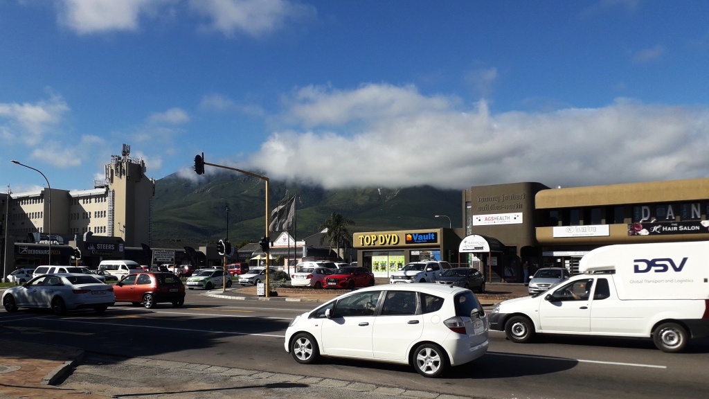
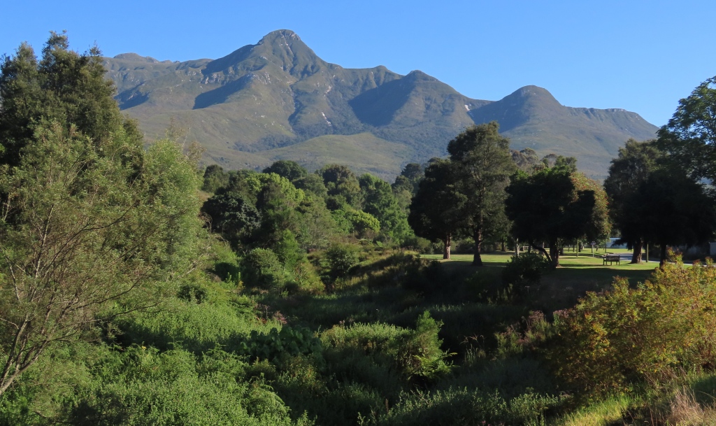
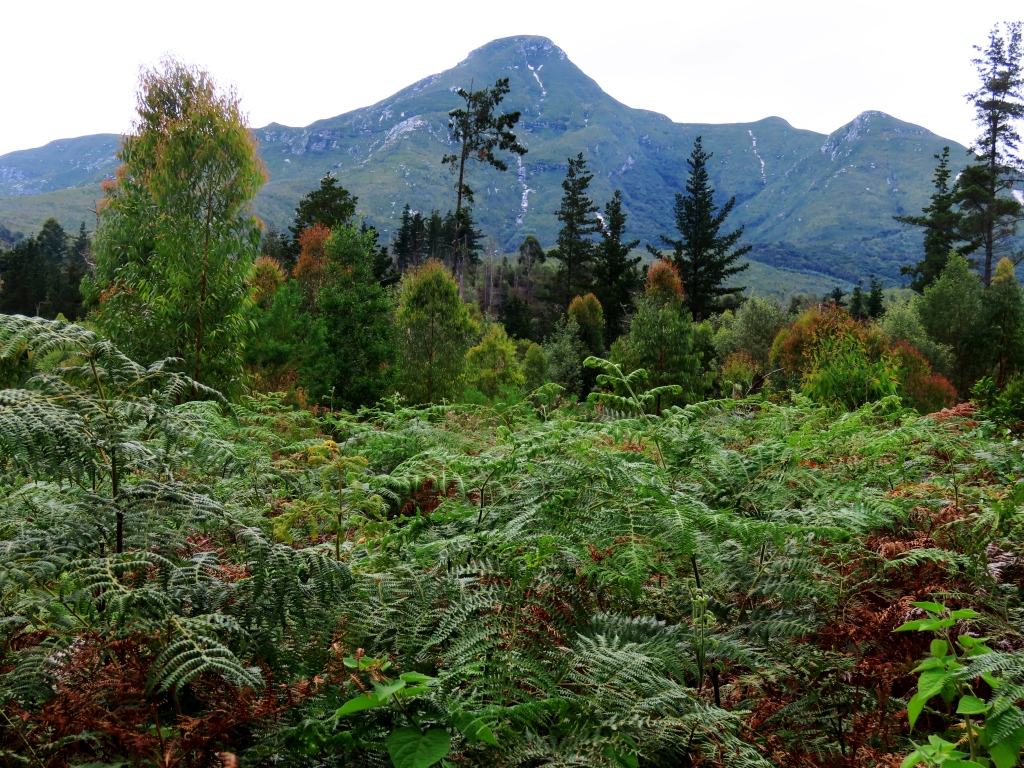
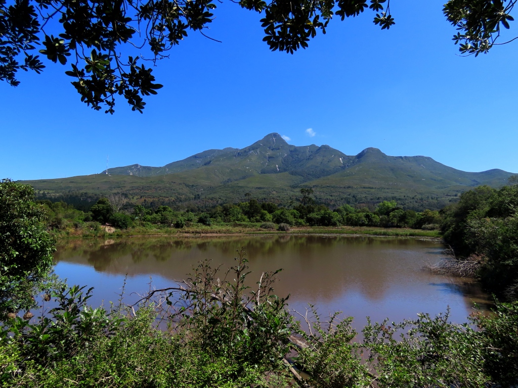
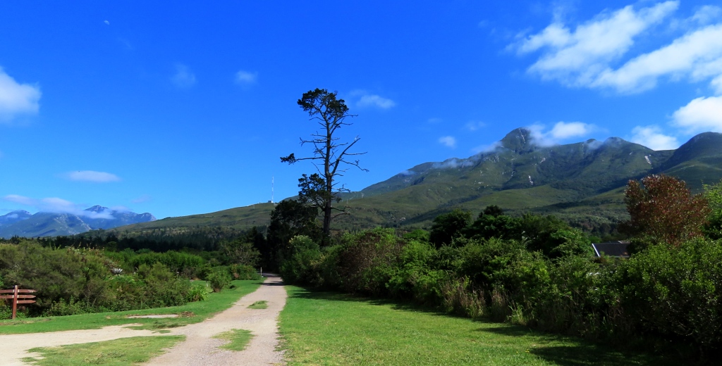
The always busy Courtney Avenue and the Outeniqua Mountains, named after the Outeniqua Khoikhoi people who no longer live there.
The George Museum has always been closed every time we walked by. The signs in this city are often trilingual: Afrikaans, English, and Xhosa (isiXhosa). By the way, Afrikaans, is somewhat related to Dutch. It was our passing familiarity with Dutch that helped me to read these writings. Maybe Afrikaans is as close to Dutch as Middle English is to Modern English.
Local school. Crime is a real concern in many parts of the city.
An unshod Afrikaner family at a store counter. I have seen this more than once in this city. And usually they are the Afrikaners who do this. Hardy soles indeed!
Some interesting signs that indicate local priorities and concerns. The mascot on the school poster is the local bird, the Knysna Touraco (see photo below).
I really like the bus system here. Very well-organized. The line “Travelling by bus should be your last resort!” is as ridiculous as it is unscientific.
A gated community with their own onsite stores and services. Good fences (and barbed wire and electronic gates!) make good neighbors.
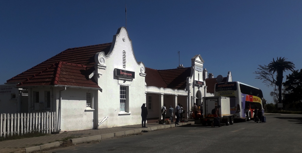
The picturesque and problematic George Bus Station. The buses are often few and far between and often late as well. Speaking from experience. Also, in order to walk to this station one has to walk through unsafe streets. Just a block or two north of here we saw men literally coming out of a hole in the wall of a building. We had wanted to take a bus from here north to Oudtshoorn but it left this station at midnight or one in the morning. Waiting around for the bus in this place at that time? No way.

But George has a lot of good qualities as well. The nature in and around the town was excellent. We had gotten in the habit of going on early, early morning walks. You see a lot more that way. Also, it usually coincides with the two hour morning power outage (to be followed by the two hour afternoon power outage. Or four!). They refer to these outages – experienced throughout almost all of South Africa – with the slightly more euphemistic term “load shedding”. I wrote “almost all” because in Pretoria, near the capitol buildings, where we happened also to stay, there was no load shedding at all. Hmm.

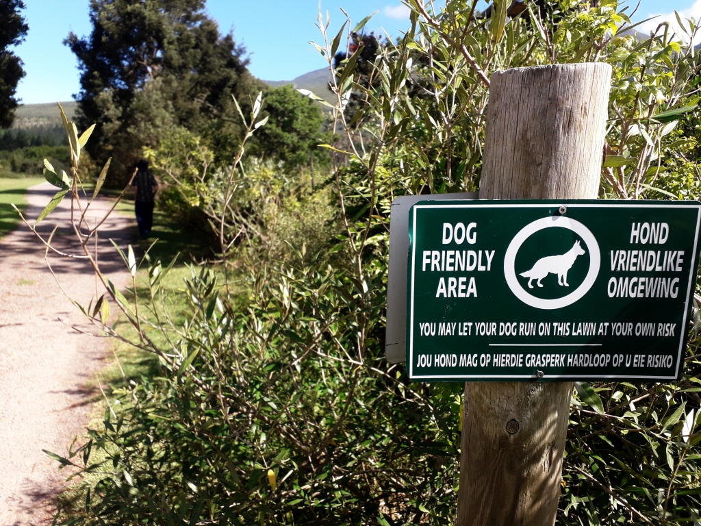
The next nine photos are from a wide nature area starting in the northwest part of the city. The closest park, the oddly named Ground Zero Bike and Trail Park, already is rich in wildlife (photos below) and just a pleasant, peaceful environment. Not sure where “Ground Zero” comes in! Continuing north, brings you extensive woodlands that march right up the mountains. To the east of these woods are the Garden Route Botanical Gardens. Supposedly there was admission charged to this park but no one was there to collect. We noticed that everyone else just walked in.

Ground Zero Bike and Trail Park
Above and the two photos Below: Wooded area further north from the park. The Camfersdrift River (stream, I would call it) weaves in and out of the area.
The Garden Route Botanical Gardens, well worth a visit, has a variety of habitats.
A train skirts the Botanical garden and curves up the mountains quite a ways.
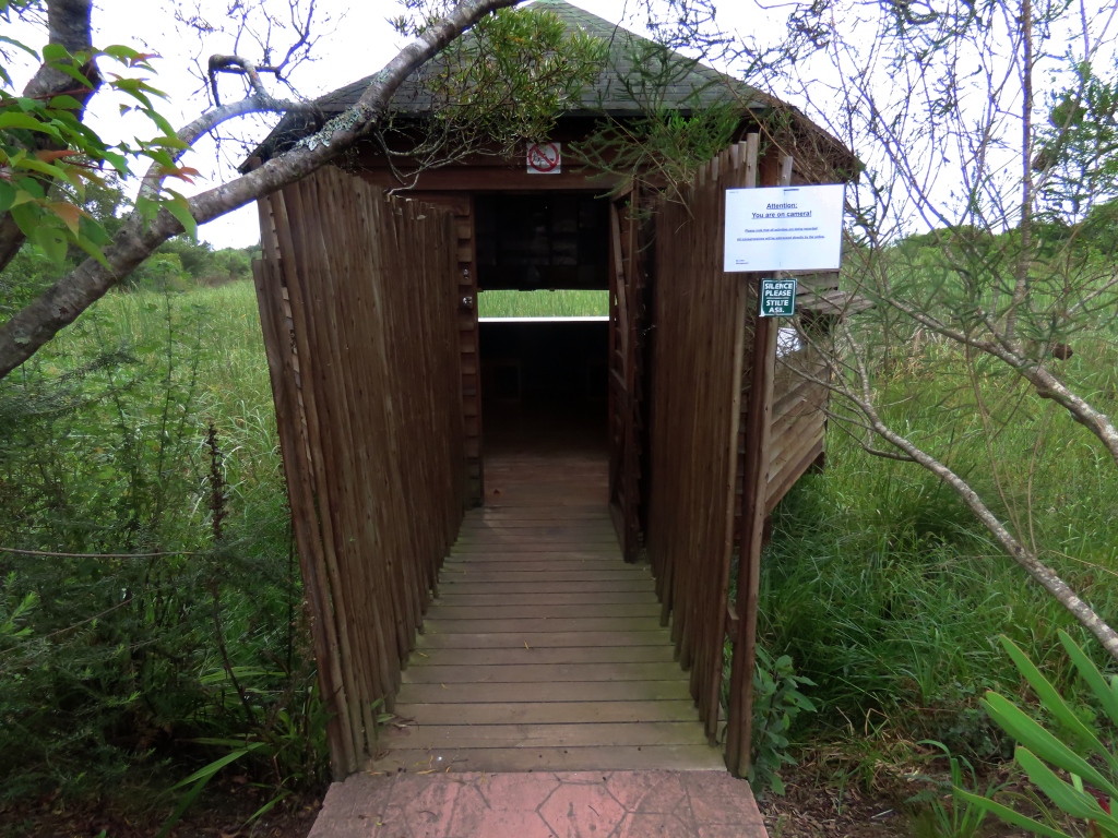
Pretty neat blind for watching birds.
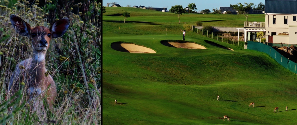
Above and Below: Another area that had nature (but not many clear trails) was near the central-west part of town where Plattner Boulevard crosses over the Camfersdrift River. Lots of housing subdivisions and a golf course with some more or less wild spaces here and there. It was in these spaces – and on a golf course, no less! – where we saw two of the antelope species of the area (photos below).
Left: Southern Bushbuck, Tragelaphus sylvaticus,
Right: These Springboks, Antidorcas marsupialis, were as numerous as they were tame.
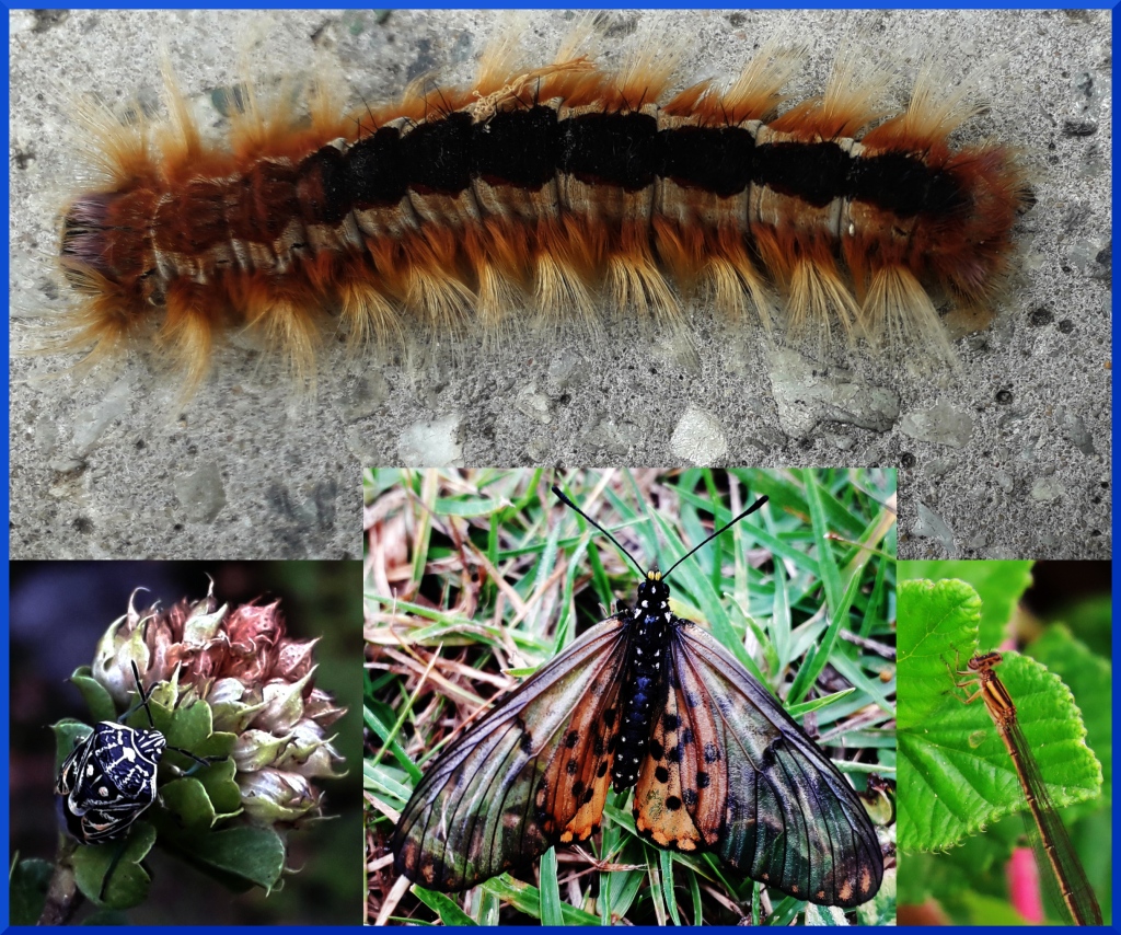
Some interesting insects. Top and Bottom Center: are different stages of the same butterfly, the Garden AcraeaAcraea horta. Left: Variegated Coffee Bug, Genus Antestiopsis. These bugs here in Africa “are pests of coffee plants, giving the coffee beans a distinctive ‘potato taste’, which is thought to be caused indirectly by bacteria entering through wounds created by the insects“.- Wiki. Right: Narrow-winged DamselflyFamily Coenagrionidae
Left, Right: Two frogs flank the Knysna Dwarf Chameleon, Bradypodion damaranum, Center.
The path that extends northward form the Botanical Gardens soon becomes a smaller well-wooded path that follows along the Camfersdrift Stream.
The area in these parks has quite the variety of birdlife. Top Left: Bar-throated Apalis, Apalis thoracica. Bottom Left: Swee Waxbill, Coccopygia melanotis. Right: Cape Bulbul, Pycnonotus capensis. This last bird is found throughout the whole city.
1: Brown-hooded Kingfisher, Halcyon albiventris 2: Cape Weaver, Ploceus capensis 3: Black Crake, Zapornia flavirostra 4: Forest Canary, Crithagra scotops. This last bird was seen in the Katrivier Local Authority Nature Reserve, another good nature area to the east of the city.
Left: Karoo Prinia, Prinia maculosa Center: Pied Crow, Corvus albus Right: Rameron Pigeon, Columba arquatrix
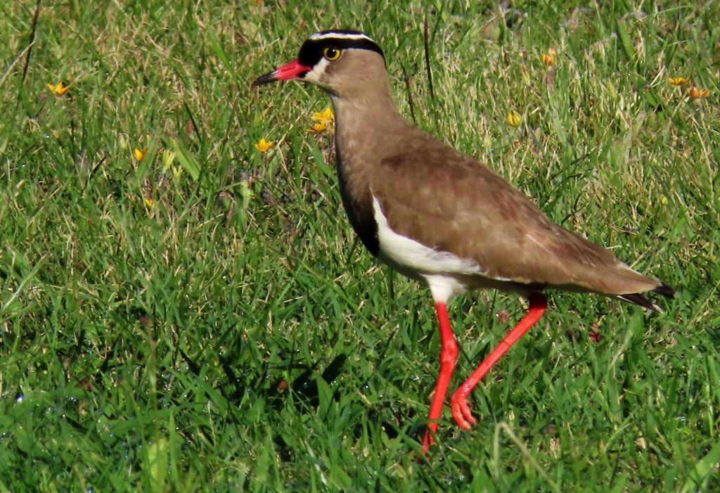
Crowned Lapwing, Vanellus coronatus. In the several towns and areas we have seen this handsome bird it has either been on well-mowed or burned-over fields.
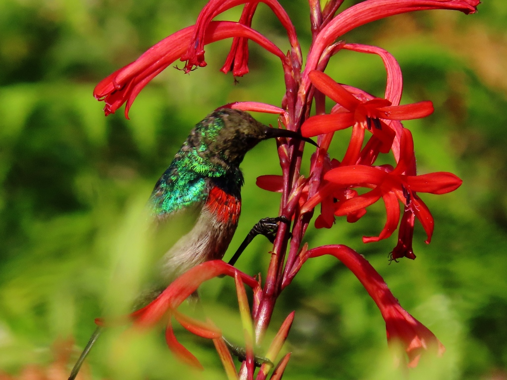
Often hard to get good shots of Sunbirds. And this Greater Double-collared Sunbird, Cinnyris afer, was no exception.
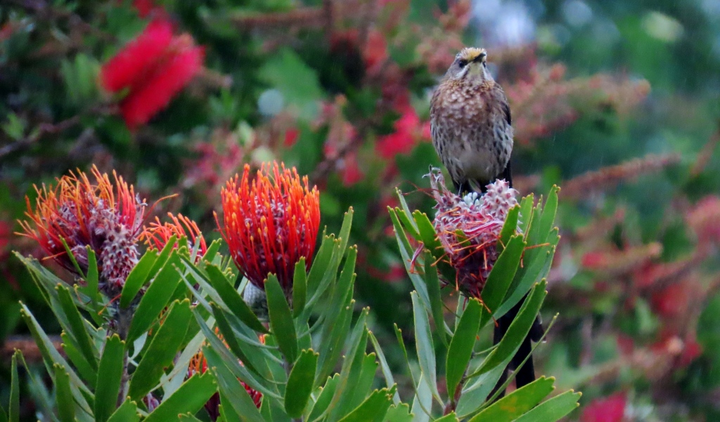
Wherever you see Proteas flowers in South Africa you might encounter the Cape Sugarbird, Promerops cafer.
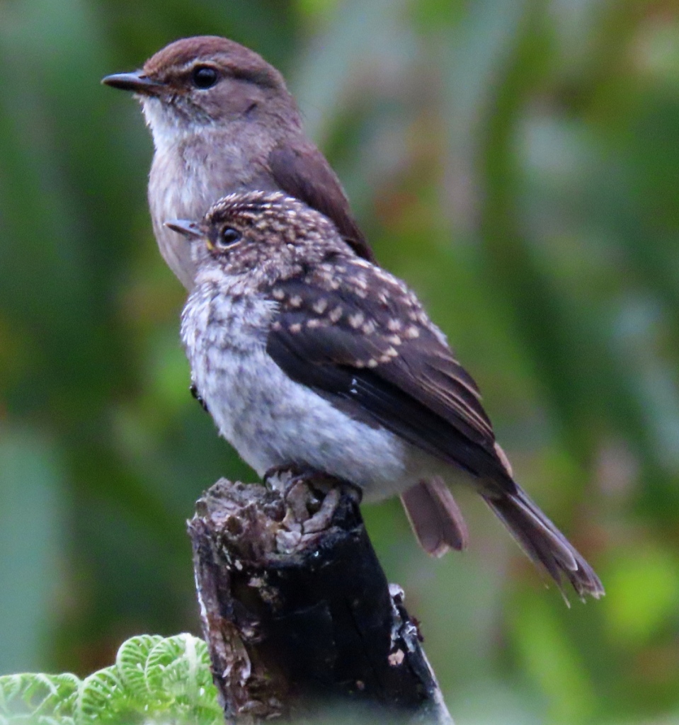
African Dusky Flycatcher, Muscicapa adusta ssp. adusta. Unlike sunbirds, flycatchers usual sit still for their portraits.
Pin-tailed Whydah, Vidua macroura
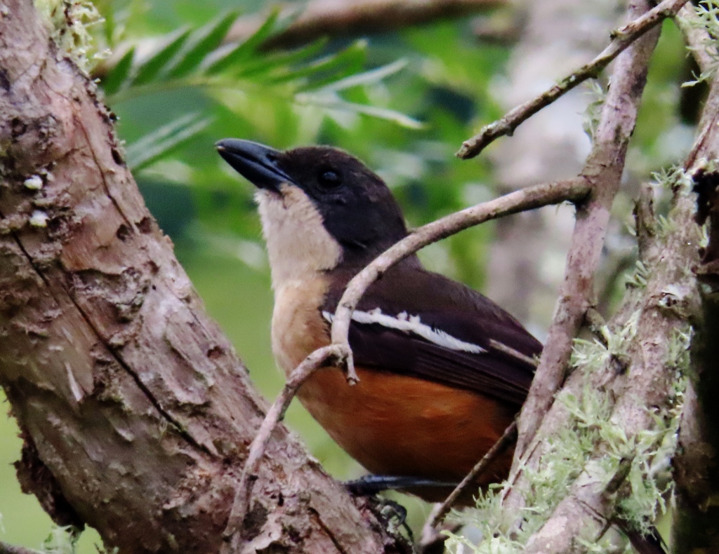
Southern Boubou, Laniarius ferrugineus. All three of the Boubou species I have seen in Southern Africa have been hard to photograph because they tend to skulk behind the foliage. I was lucky to get this shot here.
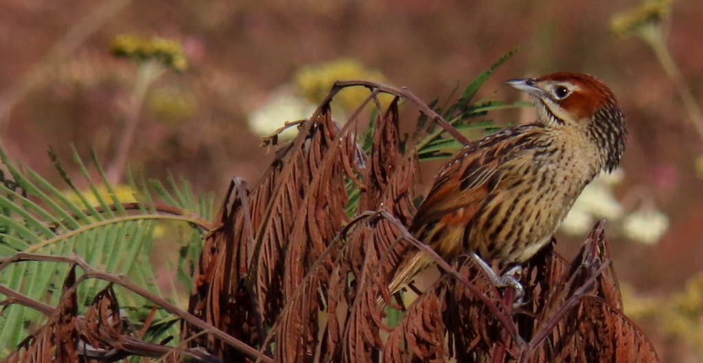
Cape Grassbird, Sphenoeacus afer
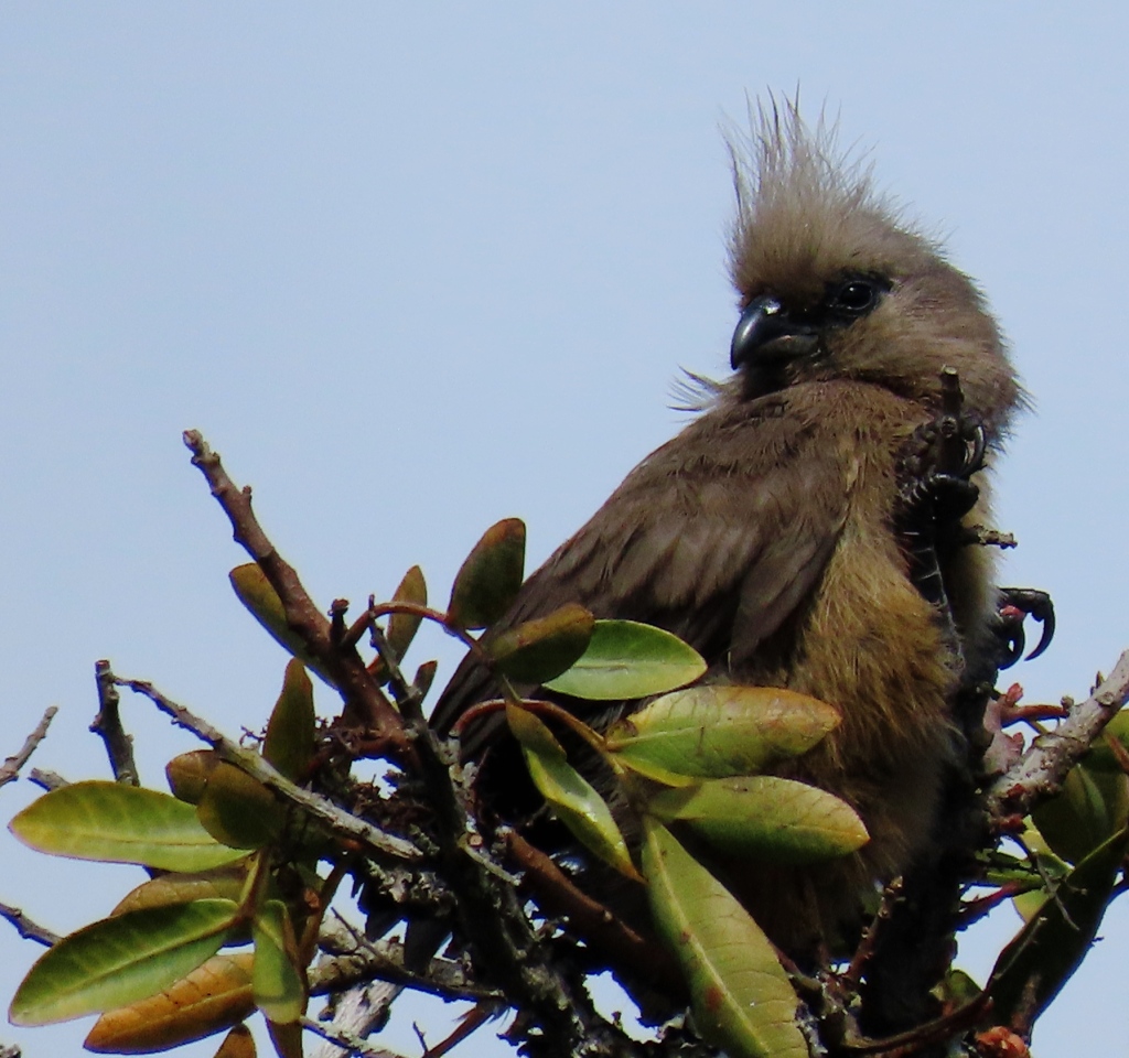
The Speckled Mousebirds, Colius striatus, usually seen in groups of three or more, slinking through the shrubby of flying around in a follow-the-leader flock.
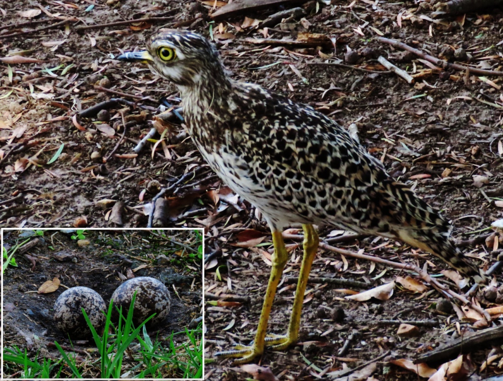
The Spotted Thick-Knee, Burhinus capensis, is not so easily spotted Their camouflage and lack of movement usually make them hard to see. One time we did see the pair of them – they almost always seem to come in pairs – on the green lawn of a city park. A dog that should have been on a leash also saw the birds and dashed toward one of them but was scared away when the Thick-knee spread his wings out wide. The eggs, by the way, were not hidden at all. Just deposited in a shallow scrape in the park. I hope they hatched!
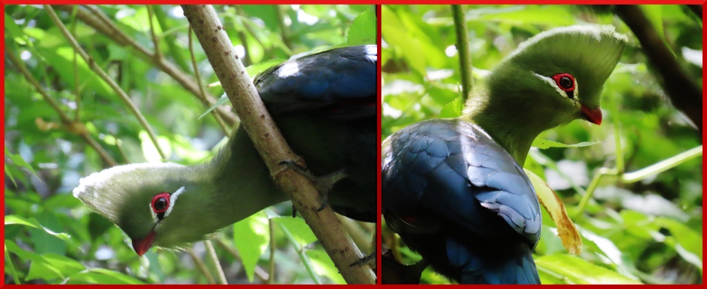
Knysna Turaco, Tauraco corythaix. Hard to find a more exotic bird than this bird. My wife and I were resting by a shady stream when this fellow wandered in, climbing down the tree to get a better look at us, I guess. When they fly they show a flash of red in their wings. An interesting fact from Wikipedia deserves mention:

“The turaco’s red pigment (turacin) and green pigment (turacoverdin) both contain copper. In fact, if you stirred a glass of water with a red turaco feather, the water would turn pink!”

Speaking of Knysna, the next article will be of nearby Knysna, South Africa.

By the way, when I first planned to write about this city I did not intend to dwell so much on negative aspects. But it is just as well that I did. I believe in a full picture of what we experienced in our two visits to this city (We stayed in six different locations!) Over all, in spite of the problems, I would not mind coming back to George, South Africa.

Vilnius, Lithuania: Our Last Stop in Europe

I tried to think of a grabby title for this entry but, well, nothing came to mind. And, to be honest, by this point much of what we saw in Vilnius was similar to what we have already seen in the other Baltic States. And, this city more touristy than the previous ones (Riga, Tallinn, and certainly Daugavpils) we were getting a bit blasé at this point. Seeing the tour groups clogging the crowded cobblestones lanes, trailing the flag-toting leader, this city began to feel like a European Disneyland. But if you take exception to these comments just chalk it up to my personal opinion. Or, as my Oma would say, “Geschmacksache”, a matter of taste!

But we did see some interesting sites and learned a few things. And we stumbled upon a country within a country (more on that below) And, ah yes! the weather was getting warmer. So there’s that.

This city certainly is photo-worthy. But first I have two views before we even came to Vilnius, approaching from Daugavpils, Latvia.

As is often the case I will upload the photos first and add more comments later. Yesterday here in Thailand we had a four hour power outage because of the monsoons.

Above and Below. Rural Lithuania. Rutted trail leads to gutted houses. Cemetery in background.
White Storks are still fairly common in this part of Europe. Many villages, like here, accommodate their needs, setting up wagon wheels or wooden frames as nesting platforms.
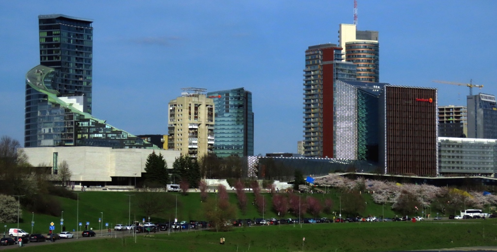
The modern city center is separated from Old Vilnius by the River Neris.
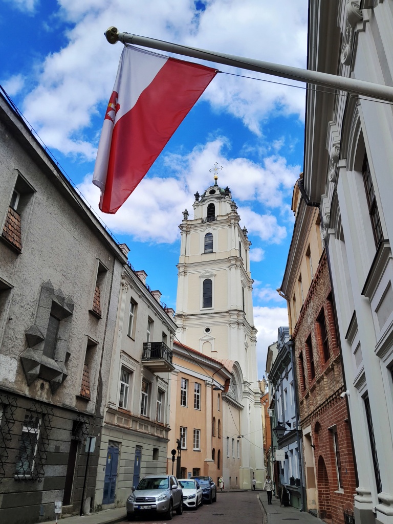
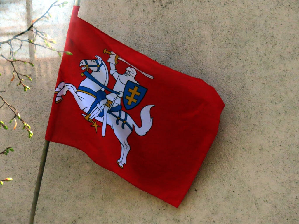
Historical national (armorial) flag of Lithuania. It was the flag of the Grand Duchy of Lithuania right up until the 18th century when it ceased to be grand. Or a duchy. The current Lithuanian flag can be seen in the photo before this one.
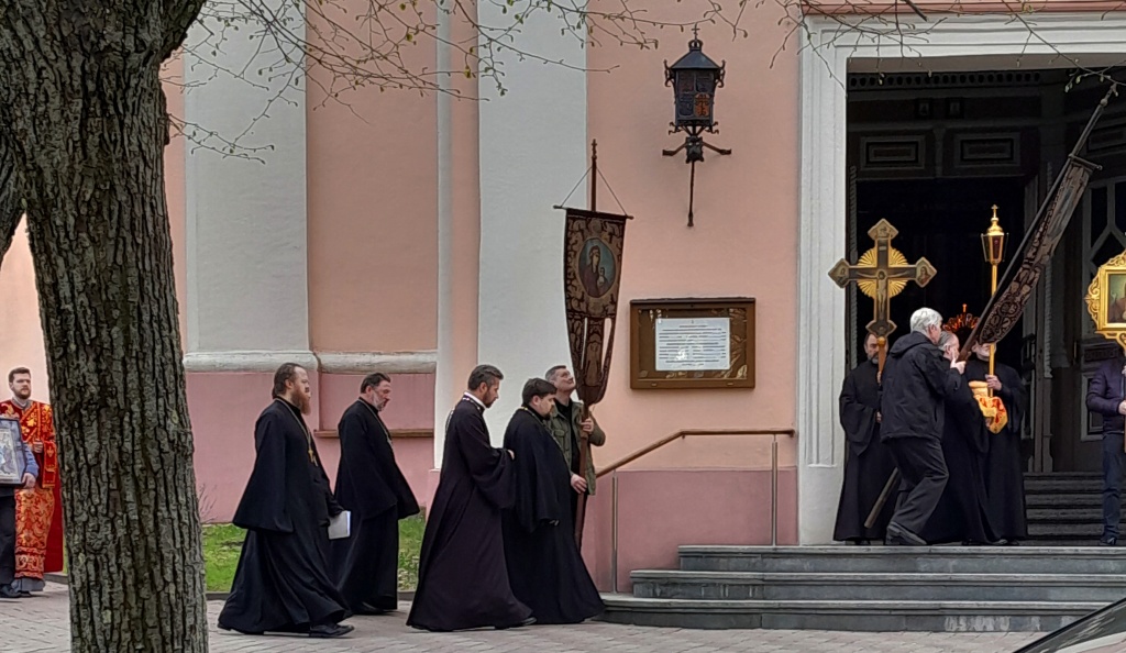
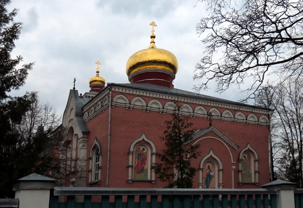
Russian Orthodox Church. “It contains the relics of the first three Orthodox martyrs in Lithuania.” (from a reviewer).
This creepy trio graces stares down from atop the entrance to a store on busy Gedimino Street.
Amber-colored chess pieces on what looks like a marble board. Chess coordinates are inlaid on the sides
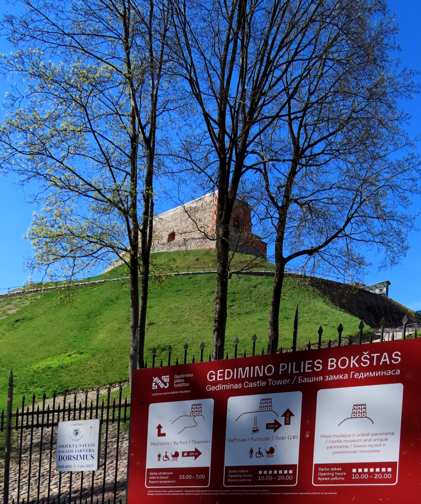
This view and the next two photos are of Gediminas Castle. You can walk up or take the funicular for a euro.
This photo can be selected to read background history on the castle and on the city’s simplifying the flow of the Vilnia River, the smaller river that feeds into the Neris.
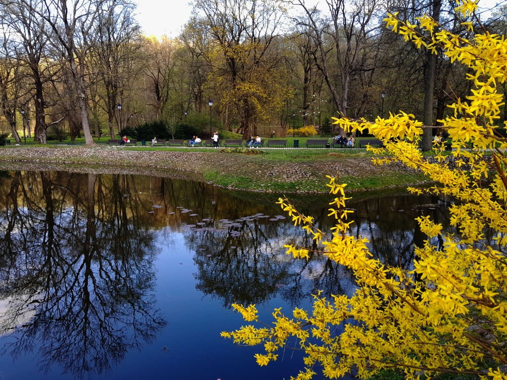
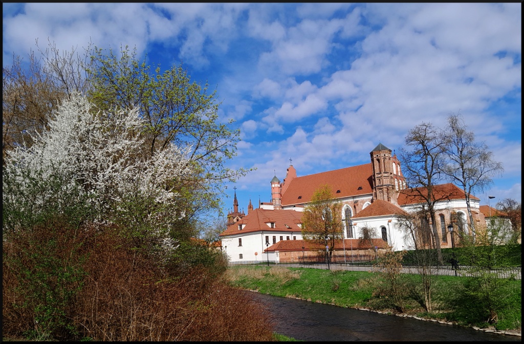
Aah. Spring is here.
The Vilnia River is pretty much controlled with paths and artificial embankments on both sides.
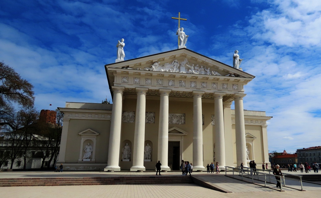
Cathedral Square: Vilnius Cathedral (left) and the National Museum (right).
The very imposing Romanesque Vilnius Cathedral.
This morning we accidentally walked into another country: Uzupis.
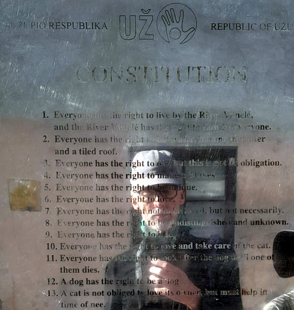
Well, a self-proclaimed republic just across the brook from Vilnius proper. They even have their own Constitution assumed self-evident rights are etched on a long series of shiny metal panels, translated into several languages. Rather quirky items here. Number 13 states:

“A cat is not obliged to love its owner, but must help in time of nee.” (sic)

We can only hope that those times of nee are few and far betwee!
A frieze just down the street of the Constitution plaques. Not sure which of the “rights” listed above are assumed here!
Confiscated scissors and lighters. I guess you would call this Found Art. Or – from our personal experience (maybe yours too!) – Lost Art.
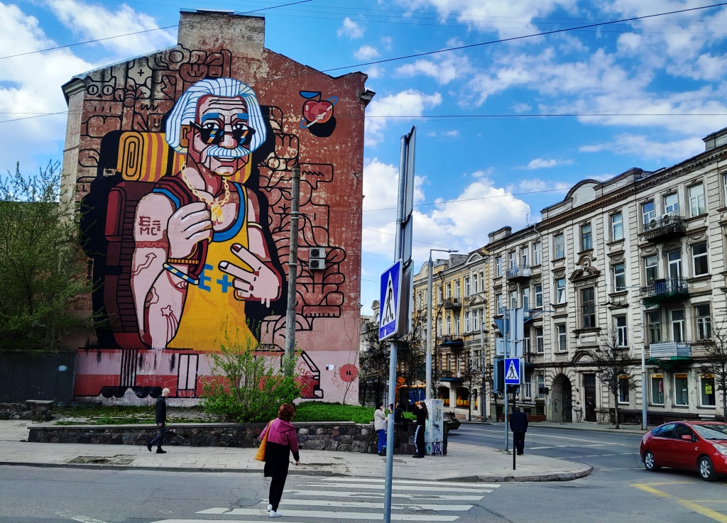
This city oozes street art. And not just in the old town.
Walking by the train station on the way to the bus terminal.
Children on a field trip to old town. Having taught all ages of students I think most about the young ones. Some of these kids will most likely live to the turn of the next century. I wonder what kind of Europe these students will grow up in. Do you ever have thoughts like this?

Next time I hope to tie up a couple of loose ends. I have one last Nicaragua article to write and a few other on the back burner.

Daugavpils: Latvian City Near Russia

There is something mentally massaging about a train ride. It is not hurried. You are not driving. You are simply watching the scenery scrolling by, a leisurely left-to-right change of view, often very interesting. We left busy, crowded Riga for the much more laid-back Daugavpils. It was a nice change of place. This city is the penultimate one we visited, Vilnius, Lithuania being the last.

Walking through the train station we continued straight down this pedestrian way that traverses the center of the town. On this street were two decent-sized malls with good grocery stores, marketplace, restaurants, an old, apparently no longer used church, and restaurants. It was pretty convenient that our apartment we were to stay at was just a block off this walkway.
Another view of the well laid-out pedestrian walkway, with the train station on on end and the shopping district on the other.
Also along the pedestrian way (behind the building) is this disused church.
Not as picturesque as Riga, but the old town still had some architectural beauties.

Daugavpils Fortress: The (Military) Glory Has Departed. The six photos below were all taken at this fortress.

This sprawling, star-shaped fortress (the last of its kind) was built in nervous anticipation of Napoleon’s sweep eastward. Construction began in 1810 but was only fully completed in 1878. But long before this time it was already obsolete; cannons were soon able to fire from much further away and thus arc easily over the walls causing many casualties and much damage, just like Lieutenant (later General Stonewall) Jackson demonstrated in the 1847 siege of the similarly-walled city of Veracruz, Mexico.

I tried to research what this is a picture is of. There were several of these openings. It would have been helpful if there had been information here or a military museum. But there is only, strangely enough, an art museum!
My first impression as we entered the fortress and climbed up the grassy ramparts, was of a ghost town. But there are actually over a thousand residents within these walls. And a hotel and restaurants and stores also. A town within a town. A town ssurrounded by a ghost-fortress greatly in need of careful renovation.

A good part of the fortress walls and some of the buildings within (photo above and below) are dilapidated, giving the impression that the fort had once seen serious battles. But not a single battle happened here. The decay was entirely caused by neglect over the years. Also, the Soviets tore down at least one of the gateways to make room for their tanks.
Eroded ramparts, horse stables, and (I think) an armory.
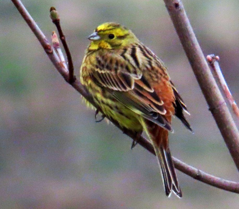
The Yellowhammer, Emberiza citrinella, sings from the ruined ramparts, “A little bit of butter and no cheese!” At least that is how my bird field guide puts their song.
Back in town, these Eurasian Jackdaws, there were two of them, were shamelessly stealing from the dog’s dish.
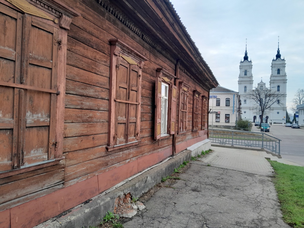
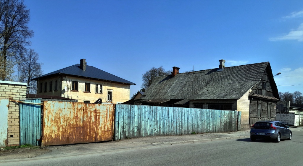
Above and the two photos Below: Wooden houses make sense where wood is plentiful.
A side street near our apartment.
One of the main attractions of Daugavpils, located on Varsavas Iela (Warsaw Street), is the Shot Tower, the oldest one in all of Europe. The shot (lead balls) is made by melting the metal on the top of the tower, passing it through the sieve (usually made of copper). The balls thus formed are dropped down into a water-filled tub. The result is perfectly round lead balls. Once a year the tower makes these balls by this traditional method.
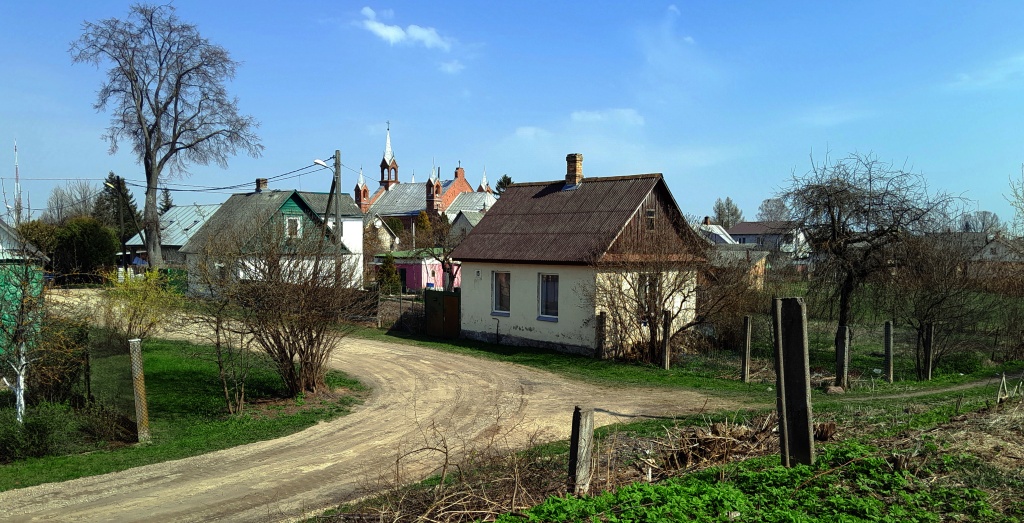
Above and Below: Two views of the neighborhood (formerly town) of Griva, which is just across the Daugava River from the main town. Walking over the bridge seemed also like walking a few decades back in time to a more relaxed and bucolic Latvian town.
Also in Griva: A colorful Orthodox Church. From what I read, a friendly and “comfortable” place of worship.
Back in the city: Orthodox Cathedral of Saints Boris and Gleb.
A most inhospitable church, the Pomors Church of Latvian Veterans. My wife and I wanted to see this church. Before entering she was sure to have her scarf on and we were both modestly dressed.
But we couldn’t even get close to the door. This old woman with fierce-looking eyes shooed us away like we were dogs! How bizarrre! The congregation is part of that staunch Russian sect called the “Old Believers”. Reading the reviews of this church on different sites I find that our experience was not unique.
Our apartment was quite comfortable. We wished to stay longer but were told that the apartment would not be available in the next days. I wonder sometimes if they maybe were balking at letting us have the booking at our “genius rate” that Booking.com gave us. So we gathered our belongings and walked the three blocks to the bus station.
… and, for a while, puzzled over our options. We knew we wanted to go to Vilnius but didn’t know when or how. But finally, with my Russian and appropriate gestures we were able to conjure up the needed tickets.
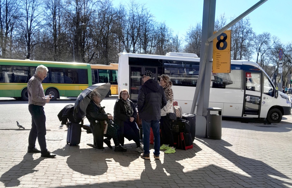
But events often do not pan out as planned. The bus was over two hours late. By the way, according to the yellow sign, buses or vans left from here to Moscow, Saint Petersburg, and Minsk. At least they did at one time.

As the minutes turned to two hours I went back and forth outside and inside, trying to get updates on just what happened to our bus. The interior of the us station was decent enough. Snacks, Soft drinks, tea were available at the far end. As we waited those two hours, I noticed that the usual hubbub in the station was getting louder and louder. A couple of men were being quite boisterous, alternately singing and shouting, obviously drunk.

Eventually the bus came. And, even with the occasional inconveniences here, I mentally added Daugavpils to the list of places that I wouldn’t mind visiting again.

But we probably won’t.


Next: Vilnius.

Five Countries in Five Weeks – Cold Northern Europe: Riga, Latvia

Of the three Baltic States we spent the most time in Latvia. And this was mostly in Riga since we found a cheap hotel right in the city center, close to the old city (pictured above).
Above and Below: Two views of the scenery on our way down to Riga from Tallinn.
The view from our window. Pretty decent view of the modern downtown. You can see a shopping mall, train station, and a Soviet-era university building locally dubbed “Stalin’s Birthday Cake“. The place here is no-frills. But that’s fine. Only $23 a night. Pretty cheap for Europe.
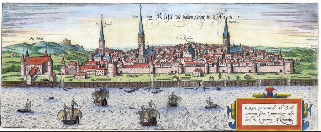
Downtown Riga viewed from the western bank of the Daugava River. Compare this view with the 1518 lithograph below. The artist’s rendering is wider in scope but you can still see some of the same churches. Several of these churches were renovated quite a bit. The lithographer used his artistic license with his rendition of hills that were neither that high nor that close to the town.
Left: Statue of the Town Musicians (or Four Musicians). Riga being a Hanseatic City, they were greatly influenced by German culture of fellow Hanseatic Cities like Bremen and Hamburg. The statue is from the famous eponymous story from the Brothers Grimm. Center: The House of the Black Heads, originally built in 1334 and destroyed in WW2, was totally rebuilt in 1999. (You can read more about this colorful organization in my previous article on Tallinn) Right: The Pulvertornis (Powder Tower) an ancient structure that still seems to have the marks of past conflicts – cannonballs lodged in it’s wall, courtesy of the Tsar’s cannoneers in the Second Northern War. Like much of the historical buildings in this war-battered city, the tower was rebuilt a number of times, lastly renovated just prior to World War 2. Pretty neat trick to rework the walls yet leave the cannonballs in situ. Actually, though the cannonballs are real, their placement in the wall was done afterward as a memorial of the Second Northern War.

Left: Another view of the House of Black Heads. Center: This cat tells an interesting tale. It was made by a a craftsman who wasn’t allowed to join a certain guild. So he bought the house across from the offending guild and placed this cat statue on top of his roof. The cat (How do I phrase this politely?) faced away from the offending guild house. Well, that guild sued this fellow and I don’t know if he had to pay other damages but he had turn the cat around! Right: Speaking of guilds these three iconic buildings are called the “Three Brothers”, perhaps in connection with the similar “Three Sisters” in Tallinn.
Left: One of two water towers, the first ones in Riga, are from 1897. Architectural details have several masonic motifs. The planner’s original intention was to construct three towers but his aspirations did not match the city budget. Center and Right: Walking through almost any part of old or midtown brings you to very interesting buildings.
Another view of the University building dubbed “Stalin’s Birthday Cake”. The design is very similar to the university in Moscow. It was built in the 1950’s. The various symbols decorating the upper floor sides (red star, hammer and sickle) are still visible.
It is easy to find examples of Art Nouveau architecture in central Riga. I would say maybe a third of the buildings have some of this style. Some streets, like Alberta Iela, are extreme examples. Every building, almost, has whimsical flourishes like the photo on the right. The left photo, by the way, is actually from the Old Town. Center: The Freedom Monument honors those who died in the fight for national independence during the time of World War 1.
The Market close to the Train Station. Buckwheat is something that we have learned to enjoy from our months in Ukraine, a basic ingredient in a good soup!
Left: The former site of Jewish Synagogue and a memorial to those killed when the Nazis came through the city. The same sad history we encountered in cities in Europe. Center: Nativity of Christ Orthodox Cathedral. A lady here gave me the stink-eye for taking this picture. You can see her just to the left of the blue candle. She’s wearing black and looking right at the heathen American. Right: Russian Orthodox Cemetery.
Left: Great Spotted Woodpecker quietly working over the trees of the cemetery. Right: Pigeons.
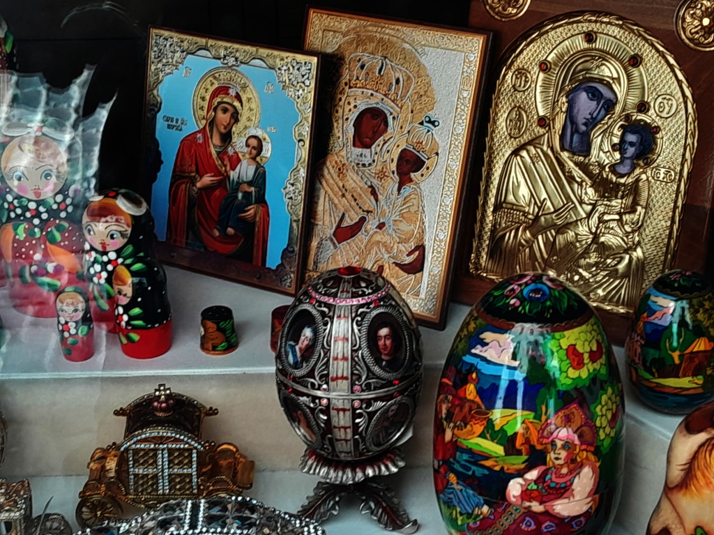
Beautiful store window display.
Next: Daugavpils, Latvia.

Colorful Divundu

“Colorful” is a good name for it, starting with the Elegant Grasshopper shown below, but also the various birds and, most of all, the people and culture in general. This is National Geographic Africa, quite off the tourist trail. However, enough tourists come through that it did not make us such an oddity, but most of them did not stay more than a day – if that. We stayed for a whole week. For many, I noticed, it was a place to fill up the gas tank, get more groceries and hard -nose it on to Katima Mulilo at the end of the Caprivi Strip. Or take the spur south to the more famous Maun, Botswana.

(BTW, currently we are in Malaysia, flying out to Borneo on Saturday!)

Elegant Grasshopper, Zonocerus elegans
Meves’s Starling, Lamprotornis mevesii. There are three or four shiny black birds in Divundu, not always easy to tell apart, but they are all striking.
Above and Below: Downtown Divundu. This is where a lot of Mom and Pop stores are, believe it or not.
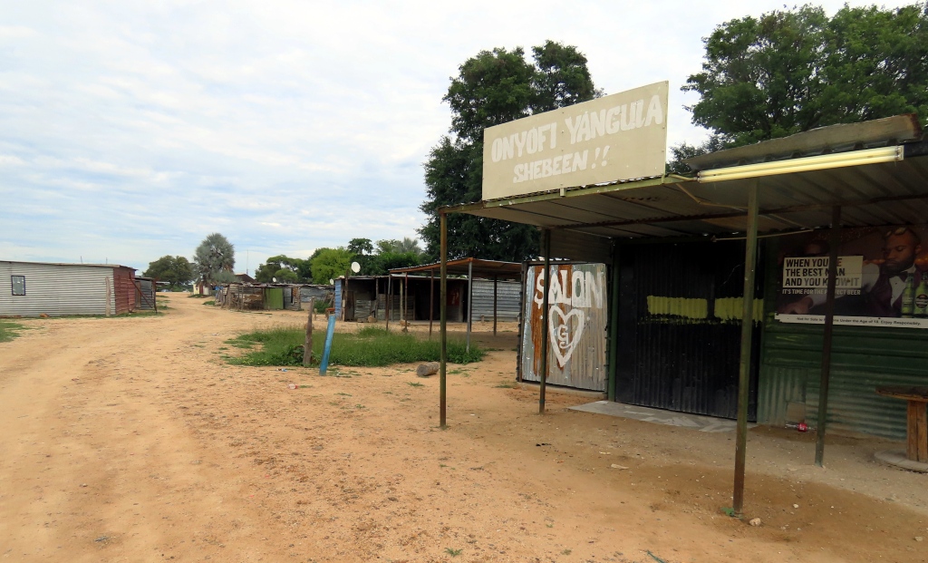
We called this the “Business District”. Later in the day it is more alive with foot traffic. The metal building to the right is a “shebeen”, basically a bar.
Cows and people – and the occasional dust-blasting car – on the road in front of our guesthouse.
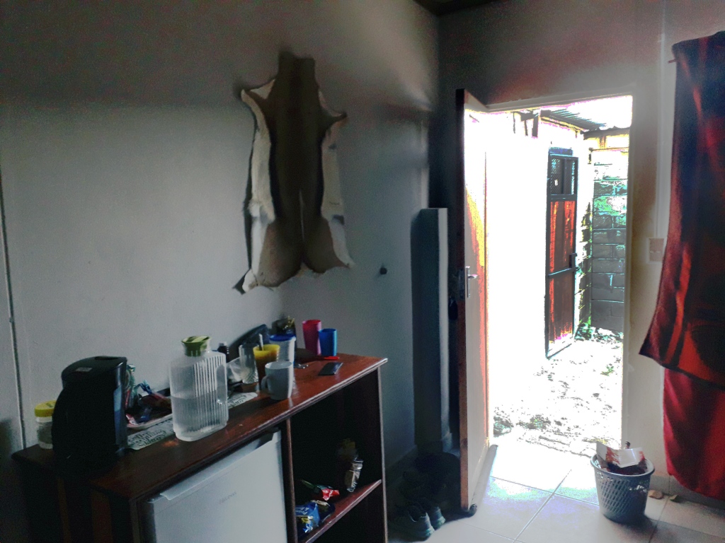
This was our digs. Notice the Springbok pelt on the wall. Not really the Radisson! But good enough for our tastes.
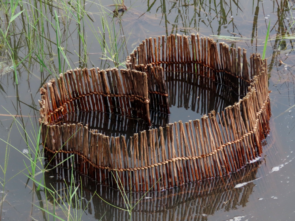
Fish trap on the Okavango River. This is actually a small-scale fishing weir. Bream, tilapia and tiger fish are caught in these waters.
Traveling the Okavango in traditional style. The makoros canoe – hollowed out in one piece from the African Ebony tree. This boat is not kind to sudden movements! Because there is no keel it is easy to tip over. Not a good idea for this crocodile-crowded river. Maybe “crowded” is too strong a word, but I did see them the last two times I crossed over on the bridge.

I would have to think that a sudden, loud splash might sound like a dinner bell to them.
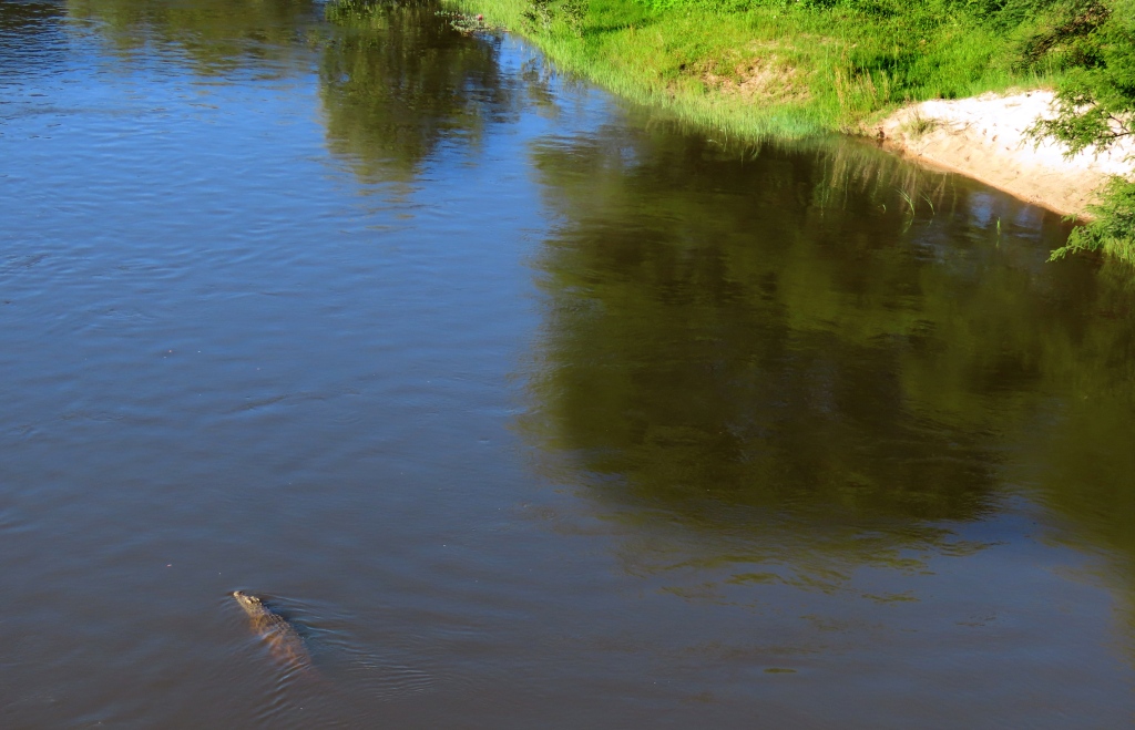
Nile Crocodile. I was glad to spot this lazy lurker from the bridge spanning the Okovango River, and not in the canoe shown above.
I hurried across to the other side of the bridge to see this fellow floating downriver like a lazy log.
The next day we took a taxi out of town. The driver told us about a crocodile that almost pulled him in the river. He still had the scar.
Crested Barbet, Trachyphonus vaillantii. Taken at the Checkpoint where we waited for a ride on down the Caprivi strip
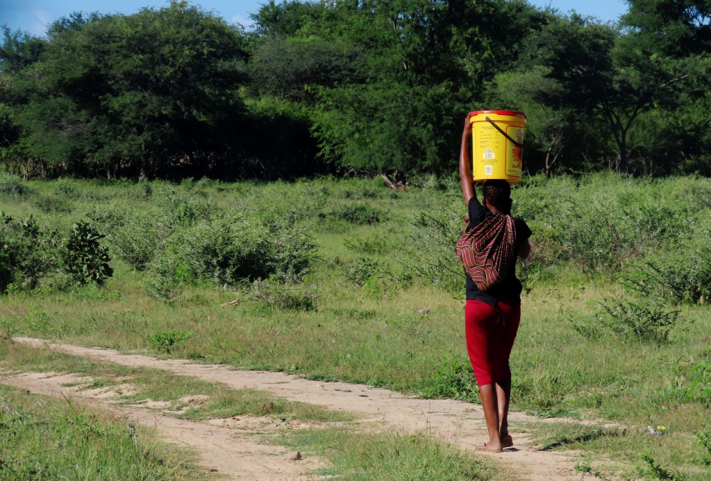
A bucket on her head, baby on her back, and phone in her hand. Triple-tasking.
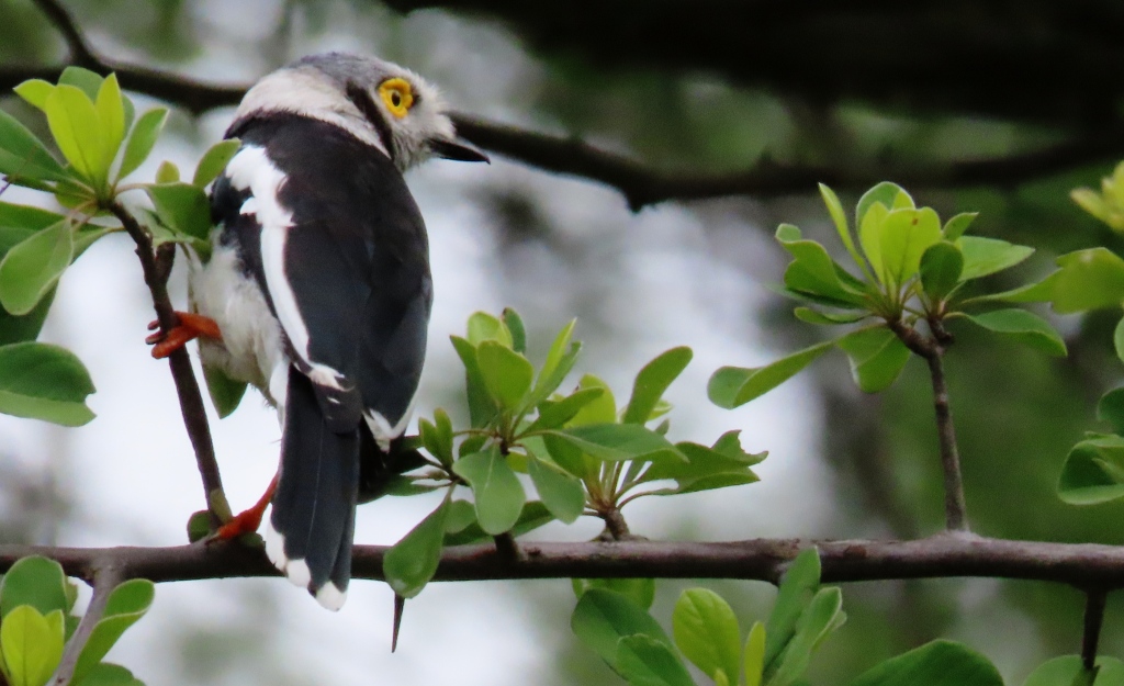
White-crested Helmetshrike, Prionops plumatus. This was a flock of maybe ten birds, which strikes me as unusual for shrikes. Shrikes usually are just in ones or twos since they have to hunt for prey. These are definitely forest birds. We only saw them after quite a walk into the Kobe National Park.
Lilac-breasted Roller, Coracias caudatus
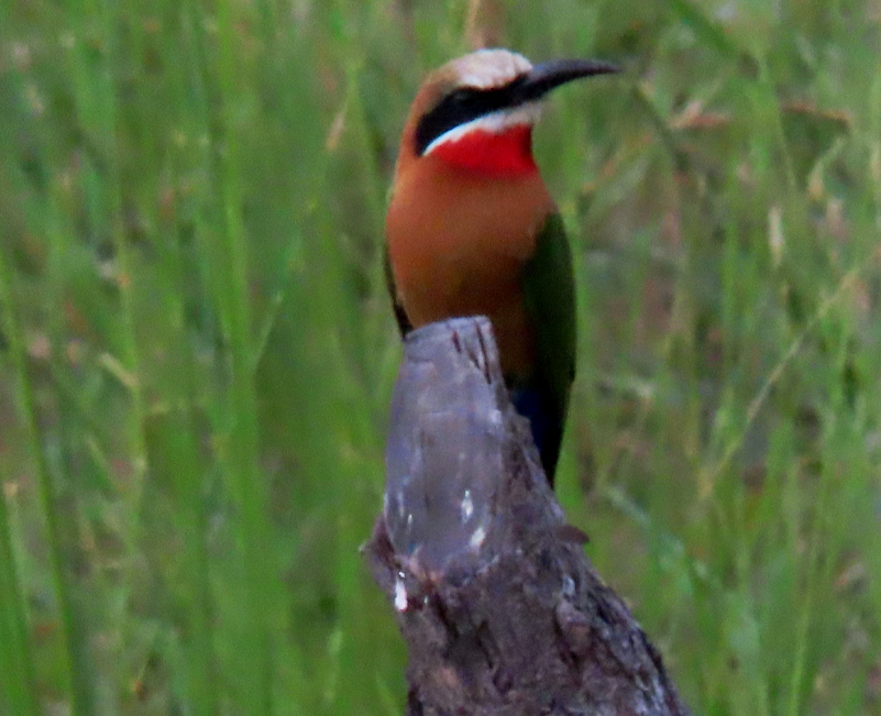
The White-fronted Bee-Eater, Merops bullockoides, was one of four different Bee-Eaters I saw in Divundu.
The tree that Zaccheus climbed, the “Sycamore” of the King James Bible is a fig tree with fruits growing from the trunk
Singing on their way to church.
On the way to fieldwork, some of them, others seem to be returning from the grocery store across the river.
These last four photos are from a private vehicle we were finally able to hitch. The guard at the checkpoint kindly did the “hitching” for us, asking driver after driver if they would take us. After an hour we succeeded. They called it “hiking”, meaning “hitch-hiking”!
Entering Bwabwata National Park.
Beautiful Ostriches showing off by the roadside.
This road had much more foot and donkey traffic than cars.

Next: Katima Mulilo

Traveling across Namibia’s “Finger”: Caprivi Strip

We have been slowly venturing like ants along the eastward-pointing finger of Namibia, spending time in Tsumeb, Grootfontein, Rundu, Divundu, and lastly in the town of Katima, in the region’s “fingernail”. A dirty fingernail that city was too, dusty or muddy streets and poor infrastructure. But a lot of friendly people. And some not-so-friendly animals.

This was going to be a one-off but, once again, the sheer number of pictures I pored over – and the associated memories – will make this a two or three-parter.

Tsumeb is the first of two towns where we spent less time than anticipated, the other being Rundu. We could not find a place that was both suitable to our budget and near to nature. Also in Tsumeb, on our first morning nature walk, we were warned by a passing local not to continue in our direction, saying that she was robbed at knifepoint. After that we thought twice about going venturing to far from town.

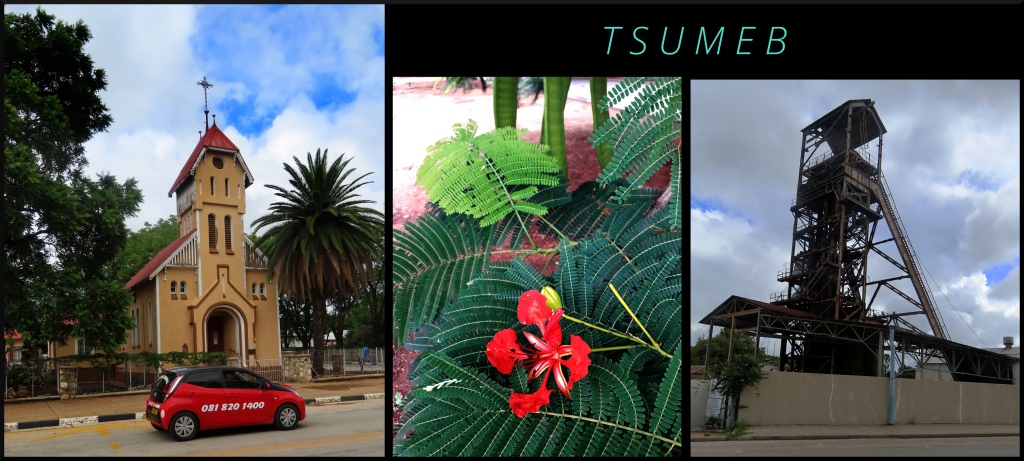
Above Left: Jeremia Evangelical Lutheran Church with separate services in German and English. Center: Flamboyant Tree, Delonix regia. Right: Abandoned shaft tower. Gold, silver, lead, and other minerals were once mined here in great quantities. The discovery to a rich mineral-producing geological pipe gave rise to the founding of the city by Germans over a hundred years ago.
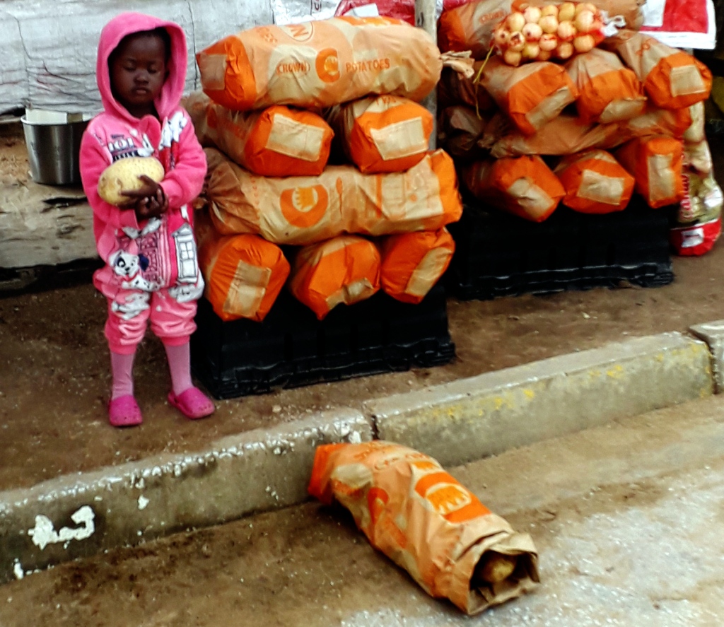
Market child has a potato for a toy.
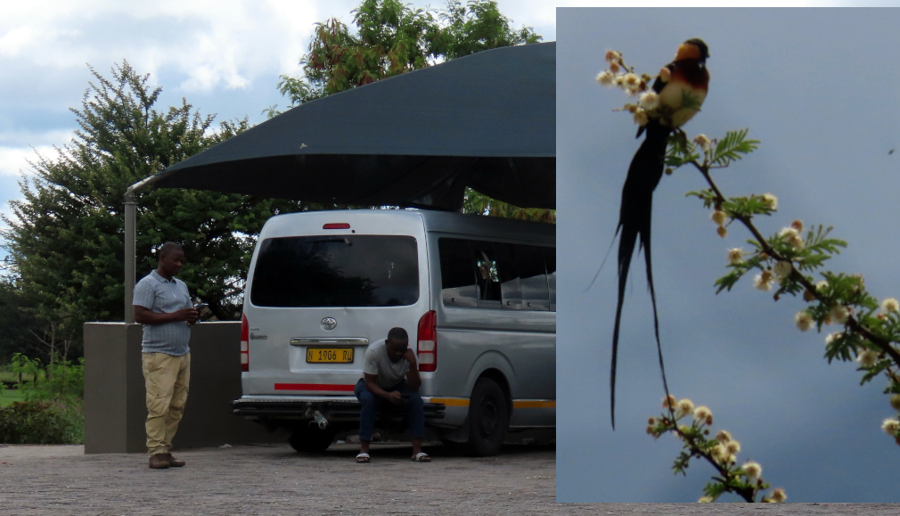
Left: Photo taken from a Grootfontein gas station where we waited almost two hours to get enough riders to go on to Rundu. It took two taxis to come up to Rundu. The driver in Tsumeb gave me the impression that he would take us all the way. But instead he did a “Guatemala Handoff”. Right: After a while I noticed there were at least some interesting birds to be seen. Above were several rare White-backed Vultures gyring far overhead, too distant for clear shots. Luckily there were birds much closer to the station like this gorgeous Long-tailed Paradise Whydah, Vidua paradisaea

Above: Hobnobbing with friends while at work. I would think the girls would not be so relaxed with the loads balanced on their heads. Below: These beasts of burden often had their own contrary agenda. It took four or five of the boys to ease them backwards into the holding area. (“Ease” maybe the wrong word!)
All four photos above were taken from our shared taxi van, waiting almost an hour for enough passengers wanting to go eastward. (We call this “achieving valence”). We made the mistake of paying the driver at first. We have since learned to try to pay on arrival. As it is, the driver made himself hard to find, in effect making us captive passengers.
Unlike in Tsumeb we did have a good nature walk in Rundu, and having a conversation of sorts with the border guards at this water crossing, just a hop, skip, and splash from Angola (the far shore seen here). After talking with them we walked a ways along the river’s edge, seeing Hornbills, Weavers, and a good variety of shorebirds.

After we were leaving a man, supposedly an official, yelled at us to come back. It seems we were not allowed to go where we went without permission (although the border guards knew where we were going and said nothing). We ignored this man, pretty sure that he was trying to soak money from some foreigners.

And this is the main reason we did not stay long here. The main nature area was ruined for us.
Left: Meyer’s Parrot, Poicephalus meyeri. Center: Millipedes don’t get any larger than the Giant African Millipede, Archispirostreptus gigas. They are sometimes well over a foot long. Right:Southern Red Bishop, Euplectes orix.

Final three photos: There were few places along the stretch between Rundu and Divundu that did not have people in view.

Next: Divundu